A weak wave moved in Thursday and dragged tropical moisture across South Florida, we could still see more downpours over the weekend as the wave falls apart.
Friday Rain Totals
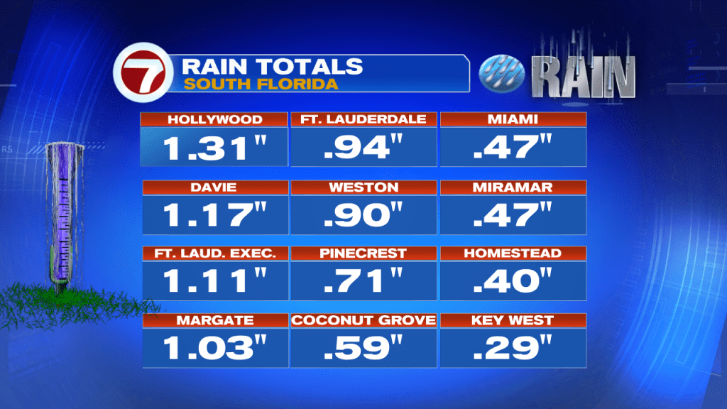
As is typical with highly disorganized waves, some areas get plenty of rain while others barely a drop. Hollywood was the wettest spot on Friday as a couple of big downpours made their way thru the area.
2 Day Totals

The forecasts on Thursday called for as much as 2 – 5″ coming down thru next Tuesday. So far, not much has accumulated in Miami or Key West, but Ft. Lauderdale has seen almost two inches. There’s still a chance for more rain over the weekend.
Saturday Forecast

The remnants of the wave will slide north still dragging moisture over us. It will not be a washout, but the rain that pops up will be heavy and that could lead to street flooding. Also, because of a new moon, we will get “extra-high” high tides that can make for some coastal flooding. Be alert if you live by the beaches.
In the Tropics
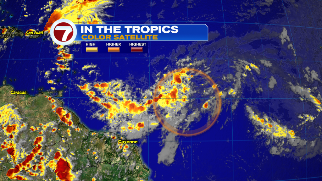
We’ve been watching a wave in the Atlantic Ocean that promised to organize. The National Hurricane Center gave it at one time, a 70% chance that it could become a depression or a storm by late this weekend. But, the wave ran into a huge wall of strong upper winds. Those winds helped to cut down the cloud tops from the developing thunderstorms inside the wave. NHC has now dropped the chances for growth.
Potential Development

As of late Friday night, the chances for organization stand at 40%. If it is going to develop, it will do so over the area highlighted in orange. The strong upper winds will nag this wave throughout its path. We are hoping they weaken it all together.
We’ll be watching