Our weather will have plenty of twists and turns from Friday through early next week, with more plot twists than your favorite Soap or Reality Show.

We begin with three main players, two of which don’t like each other very much. The lead is portrayed by the Jet Stream, a river of strong air in the upper levels of the atmosphere. It pushes everyone around with disregard, this time, sending a dome of cold air South. At the same time, warm moist air is headed north of the Gulf of Mexico. These two air masses (or supporting actors) are huge rivals that don’t like each other very much, where ever they meet, the result can be stormy. The supporting cast is rounded out by two areas of low and high pressure. Like two lesser actors, they will try to steal some of the limelight in the form adding instability to the already shaky situation.
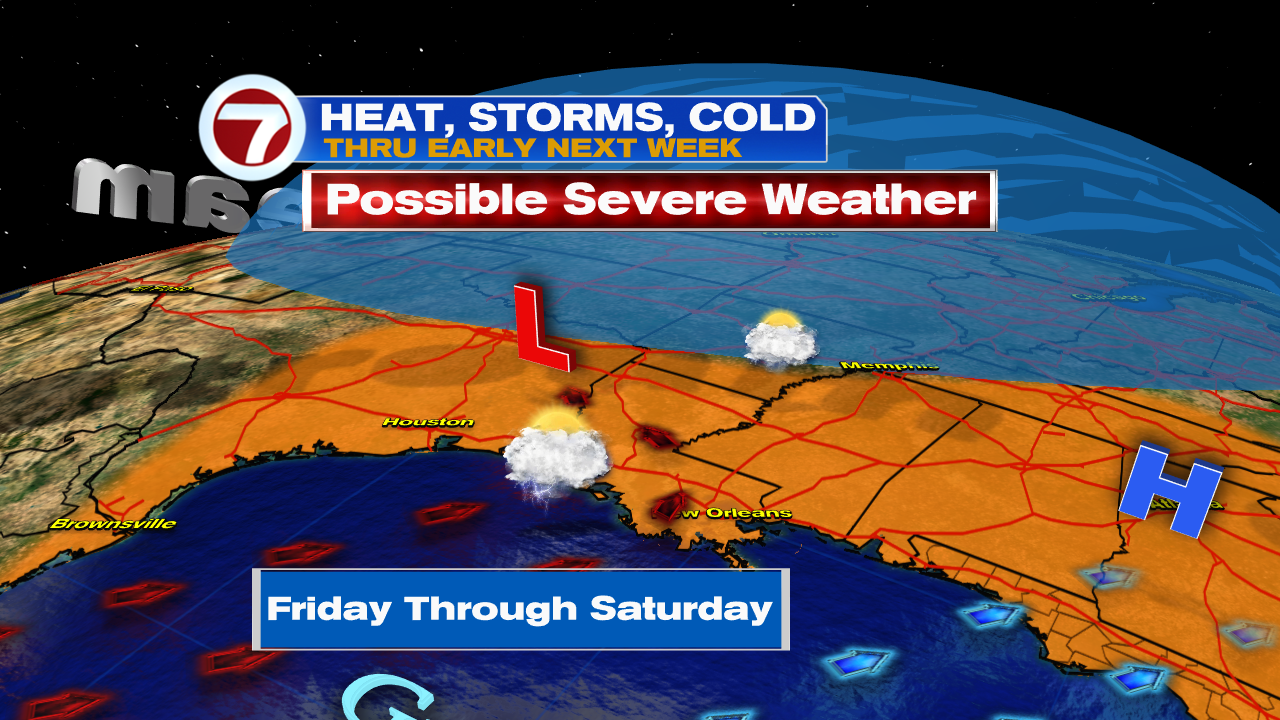
That head-on crash will take place from Texas, east through the Southeast, over the next 48 hours. All the actors will be vying for attention. The resulting skirmish could bring about heavy rain, strong thunderstorms, gusty winds, and even hail. This will be the pivotal point in the show.

South Florida will get the finale in three short acts.
- First, high heat with temps in the mid to upper 80s over the weekend. This will be due to winds out of the SSW ushering hot air and plenty of humidity. Sunday should be the hottest day of the weekend with a chance for some strong storms.
- Monday could still be soggy with slightly cooler temps. The cold air however, will not arrive until late Monday night.
- Tuesday morning should be colder with another reinforcing shot of cold air keeping us chilly until Wednesday morning.

We’ll keep watching