Happy Sunday, South Florida!
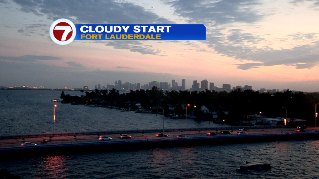
Hopefully everyone has had a nice weekend. December started off on the warm side as temperatures across South Florida have reached the 80s on multiple occasions while humidity levels have remained high each day. But it looks like the tables are finally turning for South Florida. A front came through our area earlier today and even though we’re not expecting a significant cool down with this one, some changes are expected by tonight. And these changes will be welcomed by many as we experienced another warm day in the lower 80s. And after a cloudy weekend, slightly drier air is now beginning to move in so we should begin to see clearing skies overnight tonight.
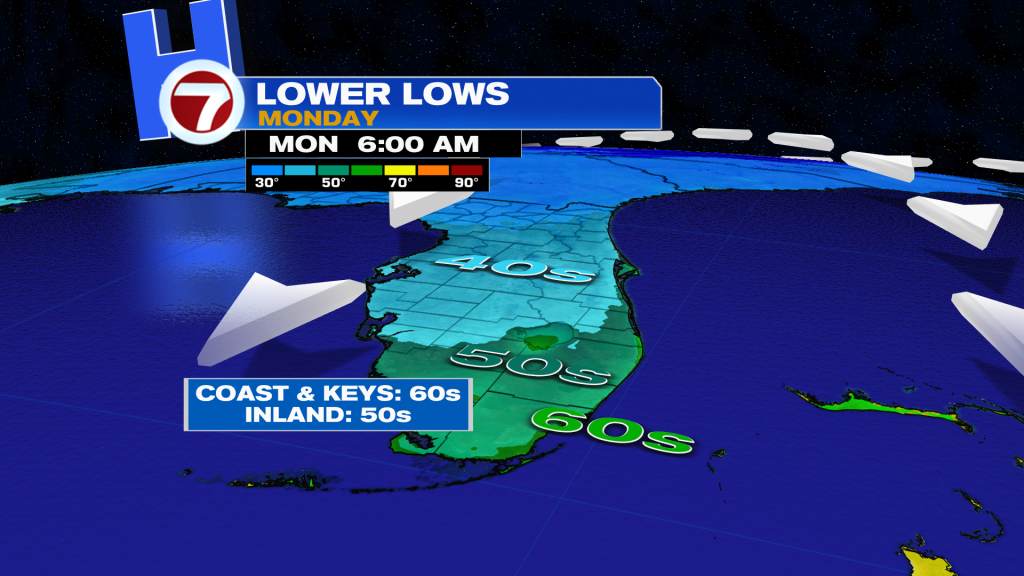
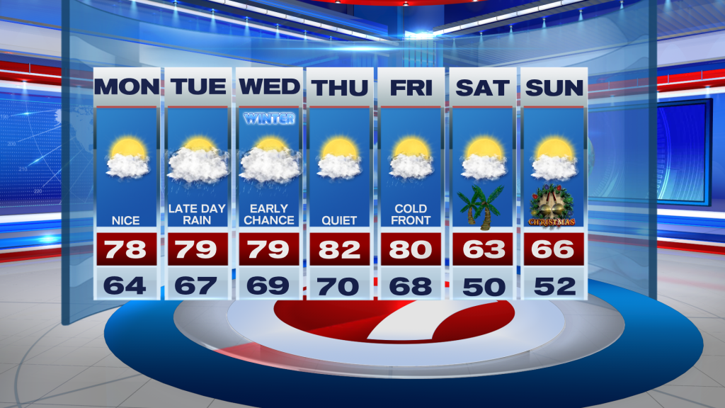
As today’s cold front continues to push farther away from South Florida, the drier and slightly cooler air will finally begin to move in. So tonight a Northerly wind component will finally bring our temperatures down a little closer to average. And even though temperatures were well above-average earlier today, by Monday morning temperatures across South Florida will be mostly in the 60s while some of our inland suburbs of Miami-Dade and Broward could reach the upper 50s. So a light sweater may be needed early Monday while calm conditions can be expected through the rest of the day. Afternoon high temperatures on Monday will reach into the mid to upper 70s while we continue to remain mainly dry.
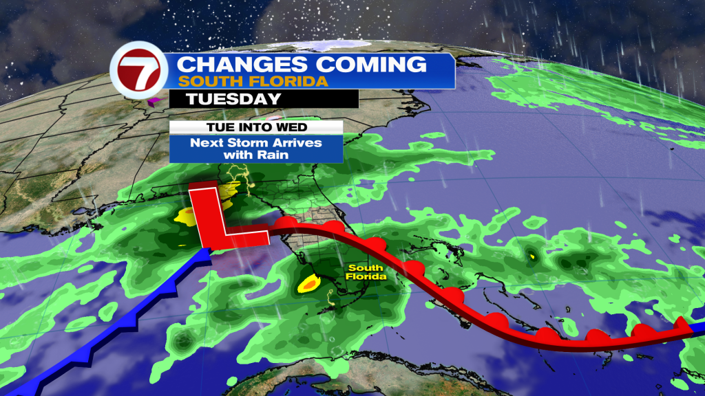
This minor cooldown will be short-lived this time around and that’s because another storm system developing in the Gulf of Mexico will be moving closer to Florida. This will increase our moisture across South Florida on Tuesday but mostly in the form of clouds. Humidity levels will rise and the rain could finally begin to move in late Tuesday night into early Wednesday morning. An isolated thunderstorm or two may also be possible during this time. And then the second half of the work week promises for the rollercoaster ride to continue across South Florida.
By the end of the week, another front will reach South Florida on Friday. And this looks to be the front that we have been waiting for since Fall started. Models are suggesting that this system will clear South Florida, and behind it much colder air will move into our state! So how cool are we talking? Well, it looks like our morning temperatures on Christmas Eve AND Christmas morning will likely be in the 50s with some pockets possibly reaching into the 40s. And if that weren’t cool enough, our afternoon high temperatures on both Christmas eve and Christmas Day will struggle to warm and will likely remain in the 60s all day. (Probably worth mentioning: some models are suggesting that afternoon high temperatures across South Florida may actually remain in the 50s! But it’s still too early to say for sure). Regardless of how cool it actually gets, one thing is for sure. South Florida may not be seeing a white Christmas but we will be feeling a major cool down that weekend, which happens to be the first weekend of winter!
Have a great week!
Erika Delgado
Meteorologist
WSVN Channel 7 News
Copyright 2024 Sunbeam Television Corp. All rights reserved. This material may not be published, broadcast, rewritten or redistributed.