The current weather pattern is one that will become very familiar. Fact is, the hazy days (from the weekend) are gone and a huge area of high pressure is controlling the region. Here’s a look at the beautiful sky during the middle of the day on Monday.

With our air flow around high pressure, we’ll have prevailing winds out of the southeast as the week continues. There’s enough moisture (with this onshore pattern) to bring occasional showers off the ocean. Some of these will bring brief heavy downpours, moving east to west.

On Tuesday’s weather map you can see high pressure located on both sides of the Florida peninsula. The dominant, or “parent high”, is the one over the western Atlantic. Isolated rain bands will traverse along the wind flow.

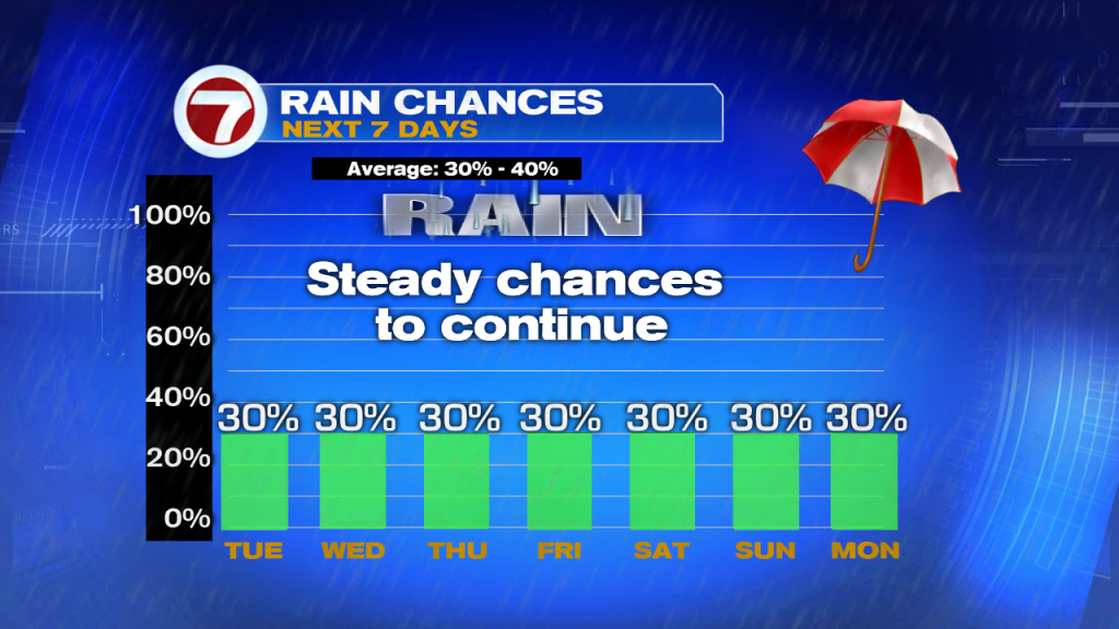
Rain chances will be consistent over the next several days. Scattered showers will be possible on a daily basis and no day looks necessarily higher than another!
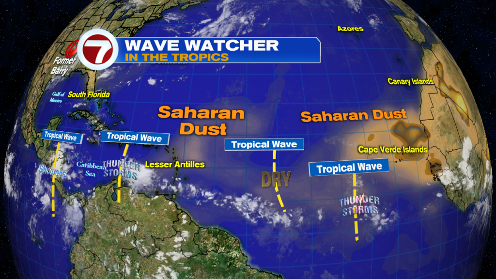
Finally, there’s a lot of interest in the tropics following the recent system known as “Barry”. The wide view of the tropics displays a parade of weak tropical waves. These (especially over the Atlantic) will struggle due to the presence of dry air. More episodes of Saharan Dust will keep the tropics relatively quiet. We’ll await the potential of future hazy days, should some of the Saharan air make it our way, down the distant road.