Happy Friday, South Florida!
While the countdown to the weekend has officially begun, all eyes are on a weak front that will swing through South Florida this evening. The famous saying “All good things must come to an end” will apply to South Florida today. After PICTURE PERFECT weather the last few days, change is officially underway.
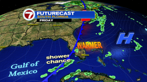

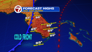
We have been keeping a close eye on the cold front that is currently drifting south across Florida. This has been a tricky one to forecast for. All of the elements needed for a stormy day across the East Coast metro areas are present today. Humidity, warmth, a cold front nearby, etc. However this cold front is beginning to lose its punch as it drifts south today, possibly even dissipating before reaching us this evening.

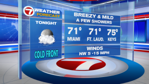
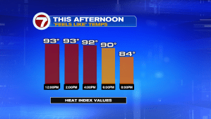
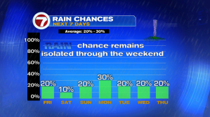
As the front approaches South Florida this afternoon, isolated showers & a few stray storms are possible. And since our afternoon won’t be a washout, afternoon high temperatures will be able to soar into the upper 80s and low 90s on today. Add the humidity to that equation and temperatures will be FEELING LIKE the 90s and even 100s across some warmer spots.


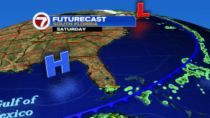
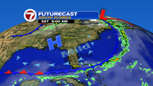
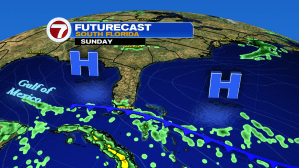
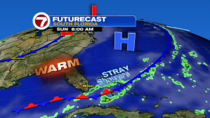
As we head into the weekend, quiet [but warm!] conditions are expected (as far as any rain is concerned), especially on Saturday as the front stalls out just south of our area. However on Sunday, the front could begin to lift north, bringing some of its moisture back into South Florida. So while Saturday remains mainly dry, we could see a few showers return to the forecast on Sunday. Good news is that any shower threat will remain isolated through the weekend.

Have a great weekend!
Erika Delgado
Weekend Meteorologist
WSVN / Channel 7 News
Copyright 2024 Sunbeam Television Corp. All rights reserved. This material may not be published, broadcast, rewritten or redistributed.