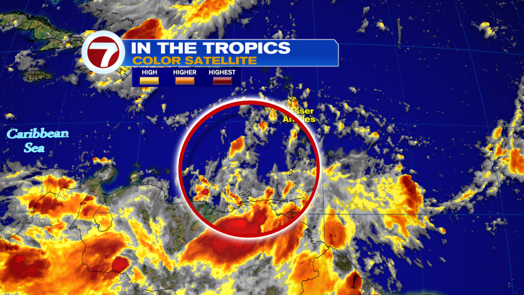
Your Storm Station is keeping a close eye on a tropical wave in the Caribbean Sea that is of interest to the United States. As of late Thursday evening it was upgraded to a low pressure area. It’s still disorganized and for now, there is no defined center, so we are watching and waiting.
This means “low confidence” on where it will end up next week because models don’t have a good starting point, so a lot of things can change down the road.
The thinking remains the same with this tropical wave and something is going to develop, but it’s best shot will be once it moves into the Central Caribbean Sea. Based on preliminary models, a turn to the North will eventually happen. However, it depends on how fast and strong this tropical wave/disturbance gets.
Here are the three possible scenarios:
1. Stays weak, could track into Central America.
2. Gradually strengthens and tracks into the Gulf.
3. Quickly strengthens and moving through the Caribbean islands and into the Atlantic.
Main models are offering two different solutions and the Gulf coast states, as well as the East coast could be impacted by this system.
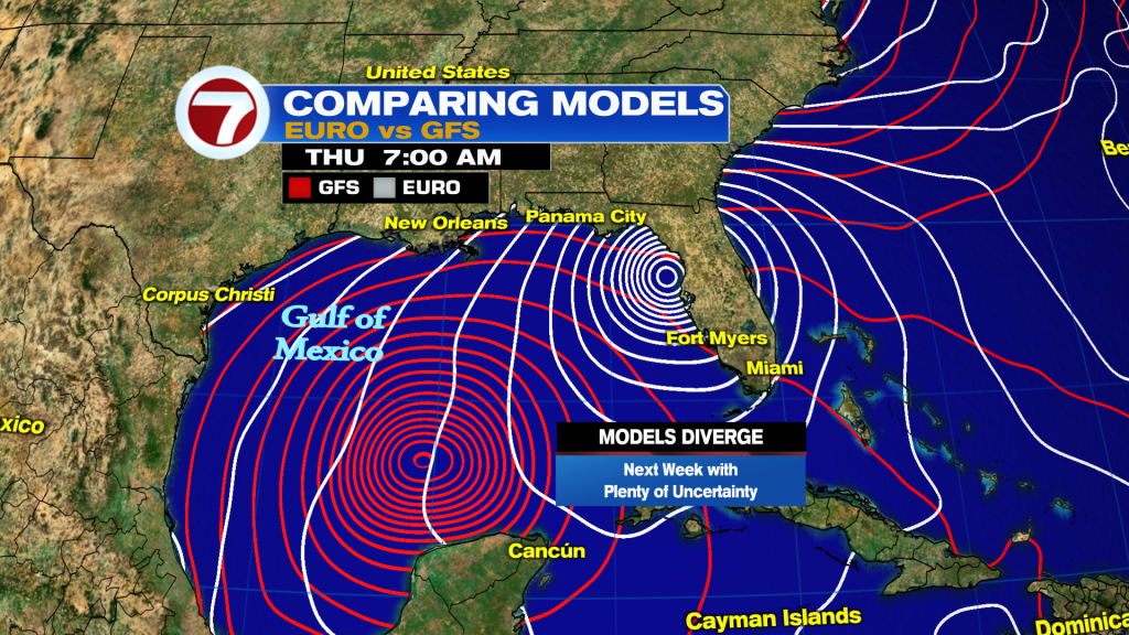
Late Thursday evening the GFS model was coming more in line with the EURO, placing a system around Florida’s Big Bend and not in the middle of the Gulf.
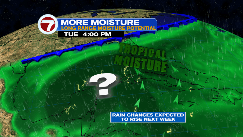
The uncertainty remains high for early next week in terms of what South Florida can expect. Right now, a weakening front is forecast to remain near the region with winds turning more out of the South-Southeast. Therefore regardless of development with the wave in the Caribbean Sea, more moisture will be drawn in our general direction increasing our rain chances gradually after Monday.
Make sure to watch WSVN your Storm Station for the latest.
Vivian Gonzalez
Meteorologist, AMS Certified
WSVN Channel 7