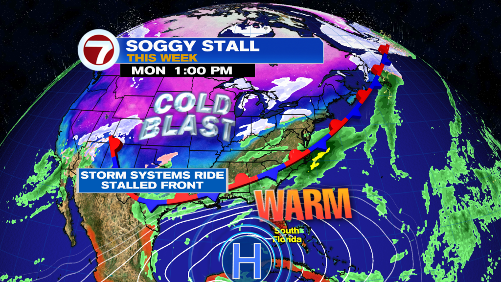
Well hopefully you have enjoyed the very brief cool down Friday and Saturday because those days are long gone now as we finally shake off the effects of a weak front that crossed through South Florida last Thursday. Behind this front, high pressure is now regaining control of our weather pattern in the mid levels of the atmosphere, which will make for a warm, bright and mostly dry stretch of weather this week.
This Sunday, expect a brighter sky with a mix of sun and clouds. Temperatures are already off to a warmer start in the 70s and highs this afternoon will be a few degrees warmer compared to Saturday’s highs, reaching the low 80s at most locations. There does remain some moisture in the atmosphere, so a stray shower cannot be ruled out, blowing onshore along the easterly breeze. That breeze will also gradually lessen throughout today, but marine hazards remain a concern especially this morning.
As we head into the start of this new week, it will be quite quiet with rain chances at a 0-10% chance due to a high pressure overhead, keeping all the weather systems to our north. Expect mostly sunny to partly cloudy skies, muggy conditions (moderate humidity levels) and above average high temperatures around 83-84F in Miami. There is even the potential for record heat this week, including on Wednesday with the forecast high of 84F.
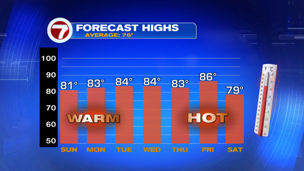
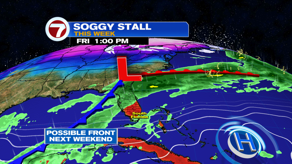
The rest of this week is also looking warm and mostly quiet. Friday is forecast to be the warmest day of the week with a high of 86F until a potential front arrives next weekend, which could usher in some showers and a drop in temperatures then.
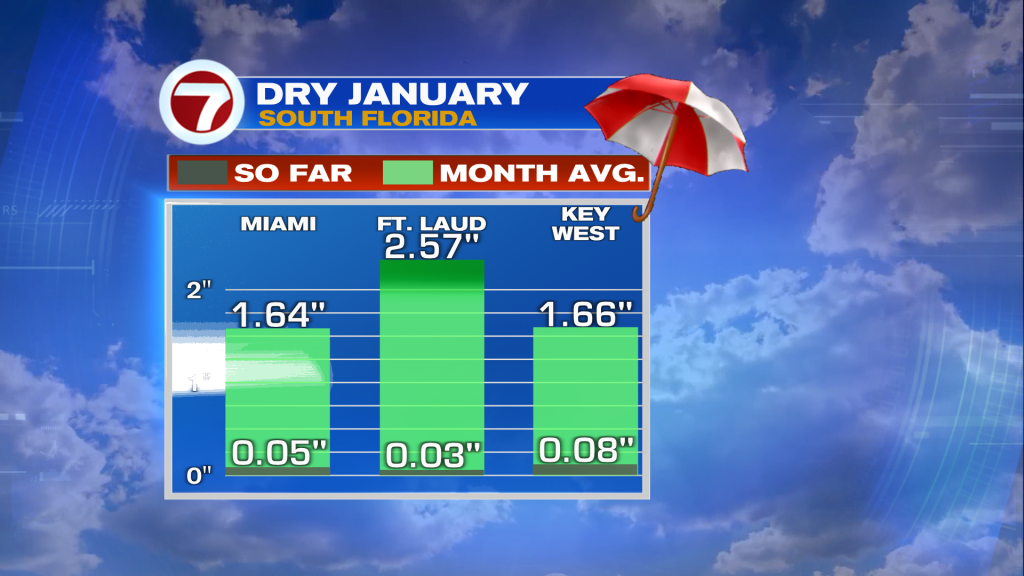
We do need the rain as rainfall is more than 1-2 inches below average month to date across South Florida.