Happy Monday, South Florida!
Hopefully everyone has adjusted to the time change that occurred this past weekend!
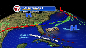
After a taste of winter last week, it looks like the winter warmth quickly made a comeback this past weekend (and looks to stick around through the start of the work week). With the return of the ocean breeze, temperatures have warmed to the above-average threshold South Florida is all too familiar with and spotty coastal showers (mainly overnight and in the morning) have returned to the forecast.

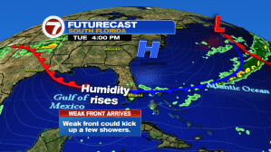
High pressure over the Atlantic has begun to weaken and push farther into the Atlantic as a weak cold front drifts South across Florida. This will allow a more Southern wind component to take shape on Tuesday, which only means one thing…..WARMING TREND CONTINUES!
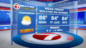
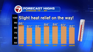
On Tuesday, stray morning showers will continue to give way to afternoon high temperatures in the mid 80s. leaving temperatures running 5-10 degrees above average for this time of year and leaving South Florida looking for relief from the heat.

And that “relief” might come with the arrival of the weak front currently over Florida. While this front is expected to stall out to the south of us, it is expected to clear South Florida, bringing a break from these sizzling temperatures (and by relief I mean we could see afternoon temperatures in the low 80s rather than the mid 80s! More importantly, humidity will be lower than usual, which will feel nice. We’ll take what we can get at this point!) A spotty shower is possible while this front is near us Tuesday and especially Wednesday.


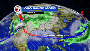
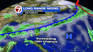
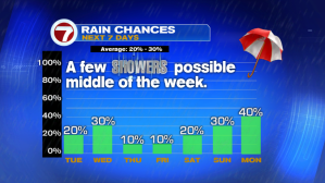
Breezy conditions and lower humidity return to the forecast for the second half of the work week. So any Spring Breakers planning on heading out to the beach next week, please remember to use caution while swimming as RIP CURRENTS will be a big threat along Atlantic Beaches by the end of the week and for the upcoming weekend. And despite the isolated showers we’ll see on Wednesday, South Florida will dry out and warm up again by the end of the week and start of the weekend. It’s not until Sunday and Monday of next week where we will see a higher chance for showers with the arrival of a second cold front. I guess we’ll just have to wait and see if this second front will bring cooler weather with it!
Have a great work week!
Erika Delgado
Weekend Meteorologist
WSVN Channel 7 News
Copyright 2024 Sunbeam Television Corp. All rights reserved. This material may not be published, broadcast, rewritten or redistributed.