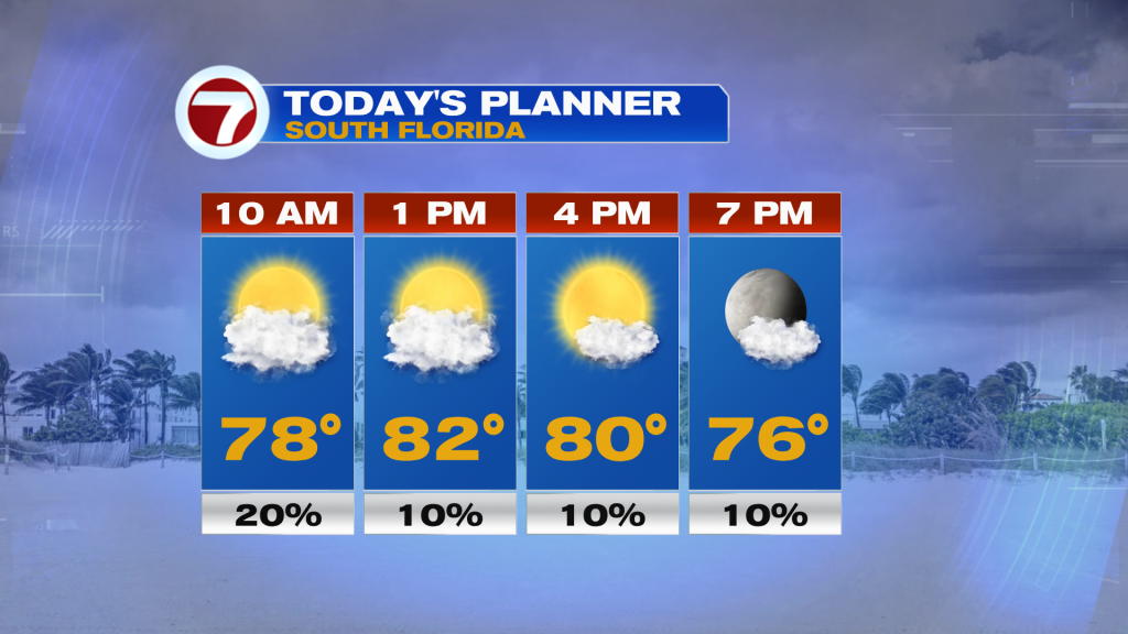
We have made it to the final Friday of the year of 2022 and it will be a nice one overall. There is more moisture creeping into South Florida courtesy of a southeast wind, so a couple spotty showers and thunderstorms will be possible mainly in the morning, however. Otherwise expect times of sun and clouds paired with moderate humidity levels, a lighter breeze and above average temperatures in the low 80s.
Given the return of a ocean breeze, overnight low temperatures this weekend and into at least the middle of next week will be 5-10F above normal, with locations near the coast waking up to temperatures in the low 70s and inland locations in the upper 60s. The Keys will generally experience lows near 70F, with cooler water temperatures actually keeping temperatures lower in the Keys compared to mainland South Florida.
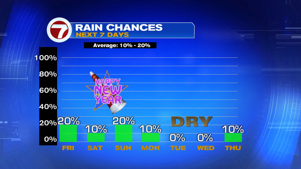
For the New Year’s holiday weekend, the story will be the nice and warm conditions. It won’t feel like December or January due to a southerly wind flow driving high temperatures both days into the mid 80s paired with moderate to high humidity, but at least it will be mostly dry under a mix of sun and clouds. A weakening cold front will slide south into central Florida this weekend, bringing scattered showers and storms to that area over the course of this weekend, but that activity should remain confined to the north. That means besides a spotty shower or two, especially in Broward County, it will be dry across South Florida on Saturday and Sunday.
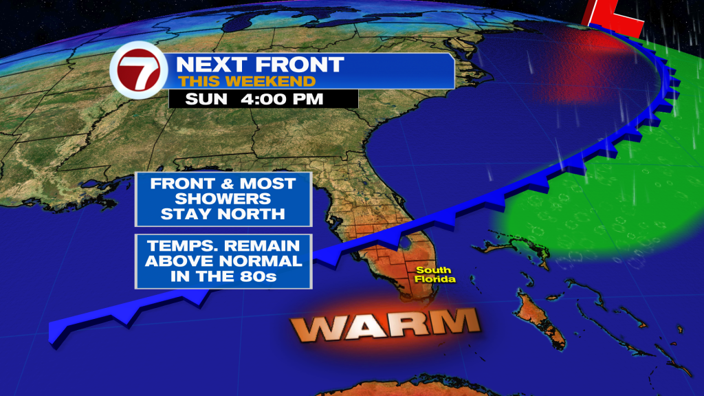
That front will start to fade away by Monday with high pressure over the Atlantic Ocean regaining control of our weather pattern. For at least the first half of the first week of the new year and of January, it will likely be dry with generally sunny skies as a result. The warm weather conditions will persist with highs hovering into the low to mid 80s, which is about 5-8F above normal.