

Happy Monday, South Florida!
Hopefully everyone had a nice weekend despite the record heat South Florida experienced. Temperatures Saturday and Sunday soared into the mid 80s but despite the late winter warmth, it was overall a nice and quiet weekend. An area of high pressure that was responsible for bringing a cool North wind late last week was the culprit. As it shifted farther into the Atlantic, it caused our wind pattern to turn out of the south and southwest over the weekend. This morning we still had warm conditions across the area as all of South Florida started the day off in the 70s while still feeling humid. The reason? All of Florida started the day off with a warm South wind ahead of a front that will be moving south through the state today.
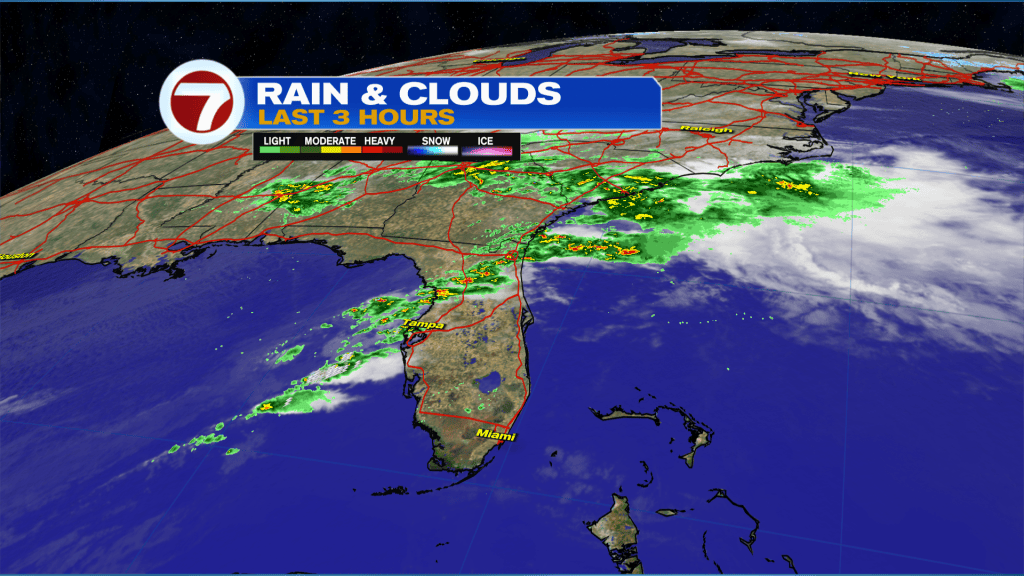
Today will be another warm and humid day but with some changes compared to what we saw over the weekend. A warm Southwest wind will once again allow our temperatures to reach into the 80s except things do begin to change for us. We will be watching our next front drift south across the state today. Early this morning showers and storms were already evident across the northern half of the state as the front drifted south across Northern Florida. For us here in South Florida, a broken line of showers & isolated storms will approach the area later this afternoon or early evening and could bring a few showers our way. However, ahead of it, South Florida will have enough dry time to warm into the mid 80s again as our wind speeds increase significantly. A Gale Watch has been issued for our local and offshore waters of Miami-Dade & Broward beginning at 2pm.
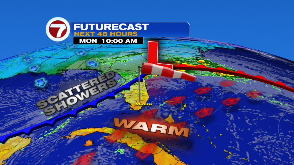
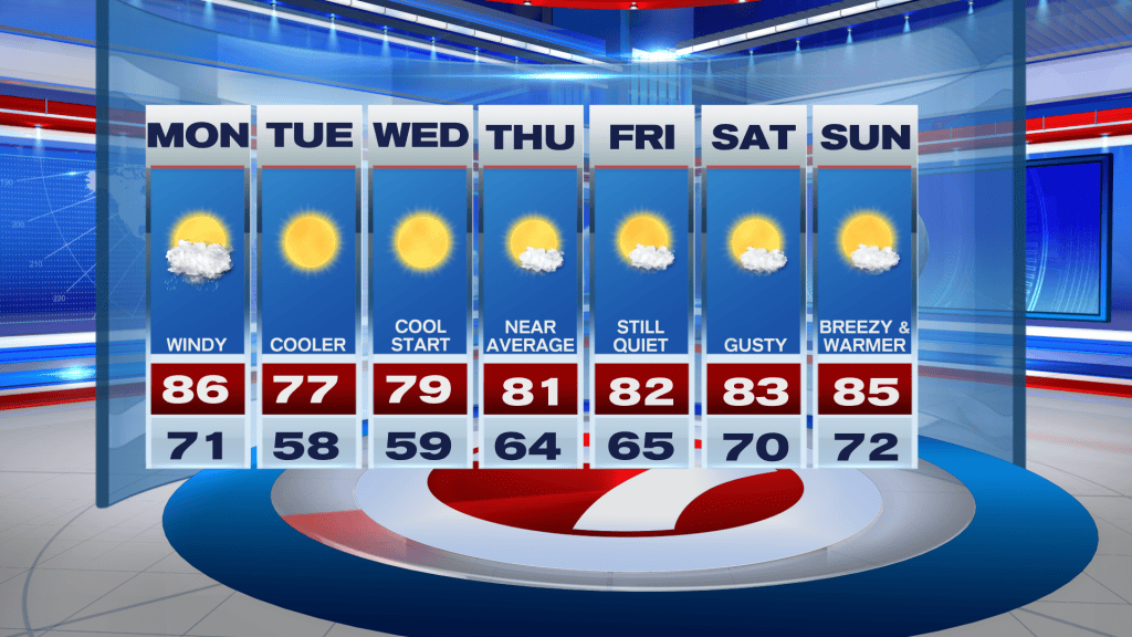
Looking ahead, the above-mentioned front will finally reach the area and bring brief relief from this late winter warmth to South Florida on Tuesday. The cooldown will be slight but it will feel nice only for things to change once again. South Florida can expect cooler temperatures in the 50s both Tuesday and Wednesday mornings and pleasant temperatures in the afternoon. By mid week, our wind pattern once again begins to turn out of the southeast and then eventually out of the south, which will cause our temperatures to be on the rise again. So similar to last week, the slight cool snap will be brief as temperatures rise into the 80s again. By late week, the breeze will once again begin to build, possibly turning breezy to windy for South Florida for the upcoming weekend.
Have a a wonderful day!
Erika Delgado
Meteorologist
WSVN / Channel 7 News
Copyright 2026 Sunbeam Television Corp. All rights reserved. This material may not be published, broadcast, rewritten or redistributed.