Happy Saturday, South Florida!
Hopefully everyone had a great week! The weather pattern has changed some as South Florida can expect an uptick in moisture through the weekend. An upper level disturbance will be crossing our area, which will enhance our shower and thunderstorm activity through the next 24 hours. This morning we woke up to plenty of scattered showers across the area and even a few isolated thunderstorms, which were mostly offshore and across the FL Keys. Our mainland locations woke up to mainly dry conditions.
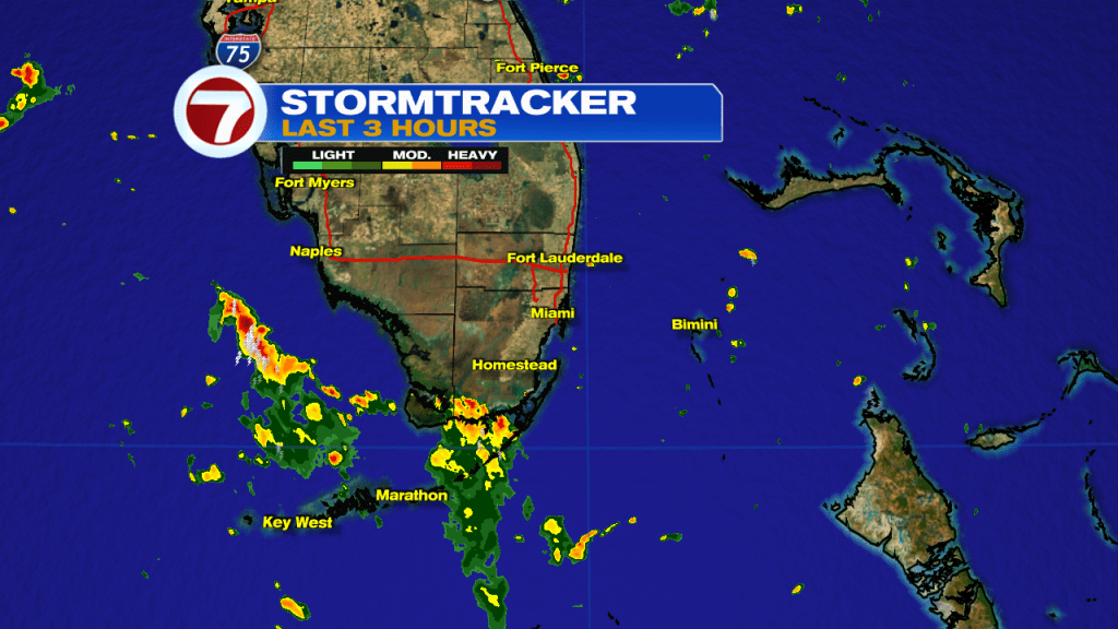
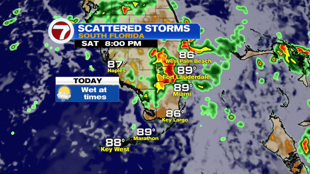
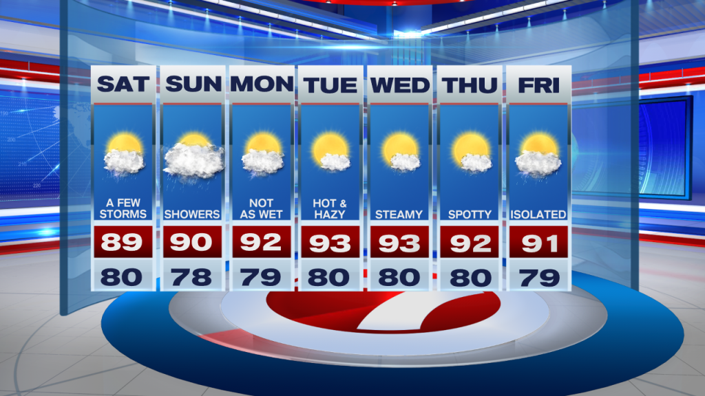
Different from the last few days, South Florida can expect better rain and storm chances throughout the day today. Best chances for the East Coast metro areas will be through the morning and into the early afternoon before most of the activity begins to push farther inland and farther north. Of course there could still be a shower or storm near our area this evening so keep those umbrellas nearby. Due to the upper level disturbance remaining nearby, some of the storms this afternoon could be on the stronger side. Lightning and gusty winds look to be the main threat, however, it looks like the strongest storms will remain west and north of our metro areas. Due to the increase in cloud cover and showers around, our afternoon high temperatures will remain in the upper 80s to near 90°, which is near average for this time of year.
While we can expect our unsettled weather pattern to continue on Sunday, there will be some changes. And while today South Florida will see plenty of thunderstorm activity, Sunday promises to bring more showers than anything, especially during the first half of the day. This is because the upper level disturbance will begin to fade over our area. As we are all too familiar with here in South Florida during the summertime, moisture will linger and so will the showers. Afternoon high temperatures will be a bit warmer and nearing 90° with a high risk of rip currents continuing once again.

Looking ahead, the start of next week will be transitional for us as we can still expect scattered showers and isolated thunderstorms in the forecast on Monday. However we can expect some changes in the forecast after that as an area of high pressure builds back into the region while a layer of Saharan dust possibly reaches South Florida once again. Together, they will lower our rain chances and bring back those hot, hazy and humid days that we experienced not too long ago. This also means that rain chances will be suppressed during the middle of the work week and South Florida will once again see mainly dry conditions during this time. Of course, this is *only* if the Saharan dust actually reaches us again. In the meantime, be sure to keep those umbrellas nearby this weekend.
Have a wonderful weekend!
Erika Delgado
Meteorologist
WSVN Channel 7 News
Copyright 2024 Sunbeam Television Corp. All rights reserved. This material may not be published, broadcast, rewritten or redistributed.