It was a “Mixed Monday” with a switch between sunshine and rain. The rain showers didn’t last very long. The reason? A sturdy onshore breeze carried the moisture along fairly rapidly. The winds, off the Atlantic, ranged from 10 to 15 miles per hour throughout Monday afternoon.

Here’s the rundown of rain amounts. Again, because of the “speedy showers” we didn’t see totals that were significant.

Typically, August is sweltering but we’ve been hotter than usual across south Florida. In Miami, the “heat streak” continues with 16 consecutive days of highs in the lower to middle 90’s. It’s the hottest period in over a year!

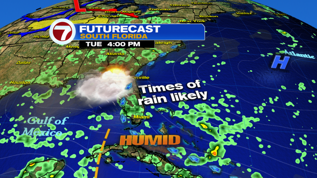
The main weather story for now involves a large shield of tropical moisture that’s pressing our way. It follows a weak tropical wave (which passes to our south over the next 24 hours).

The Tuesday weather map has the region in a wet zone. Basically, we’re situated in a pattern that will favor slugs of rain. Steering winds will push showers across the region so be aware that heavy downpours are likely at times.
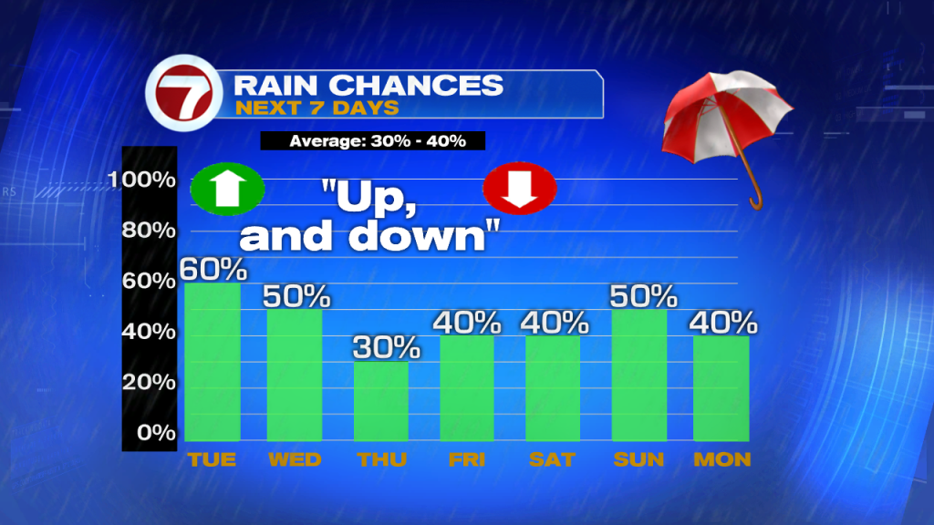
High-trending rain chances will hold through Wednesday. Then, chances will slide back to seasonal (with fewer and more scattered showers).
Across the tropics, it’s relatively quiet for this time of the year. We’re following three weak tropical waves that pose no threat of developing over the next several days. Part of the reason these waves are struggling is because of ongoing episodes of Saharan Dust.
