Happy Sunday, South Florida!
Hope everyone had a nice start to the weekend. It was picture perfect across South Florida as we enjoyed plenty of sunshine during the afternoon hours and low rain chances. Slightly drier air kept our rain chances at a minimum and any storms that did develop were focused across interior sections of South Florida or out across the west coast. This morning we woke up to a few isolated showers but similar to Saturday, temperatures were in the mid 70s. One difference we noticed is that today we woke up to mostly sunny skies.
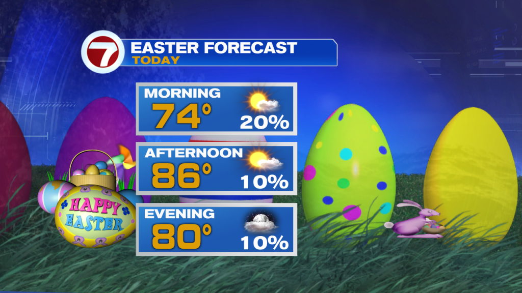
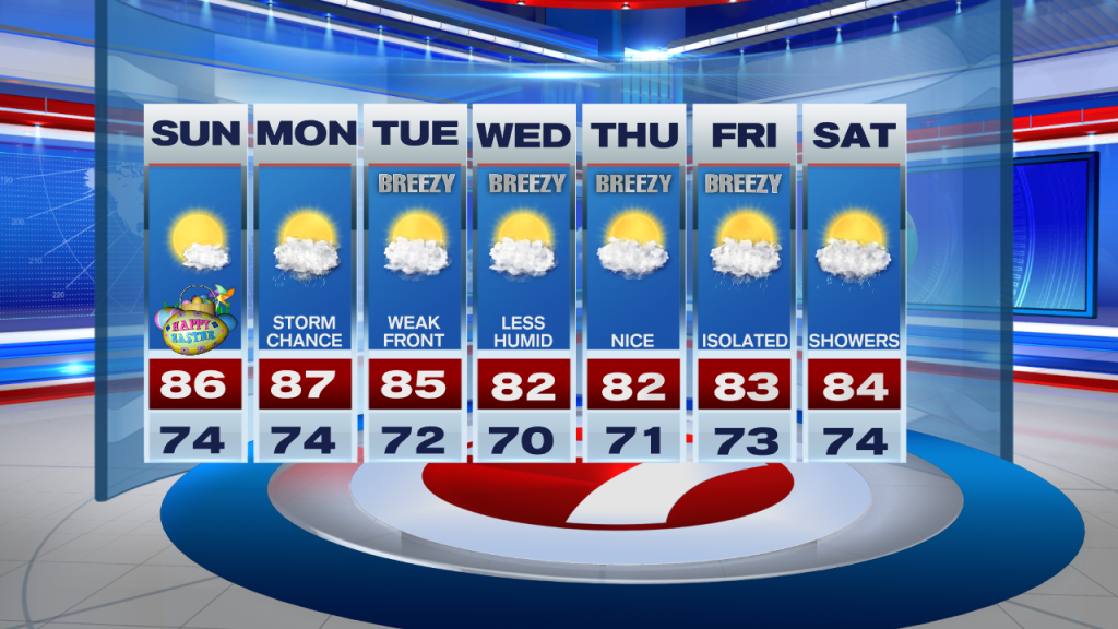
Today we can expect a similar setup as the first half of the weekend. A few morning spotty to isolated showers will eventually push out towards intersections of South Florida and out towards the west coast. As for the SE coast of Florida, we can expect rain chances to remain low under plenty of sunshine, warm temperatures in the mid to upper 80s once again. However due to the added humidity in the air, our FEELS LIKE TEMPERATURES will be in the 90s so be sure to keep water nearby if spending any significant time outdoors today. Today we get to enjoy those beautiful blue skies for one more day before the weather pattern begins to change on us once again.
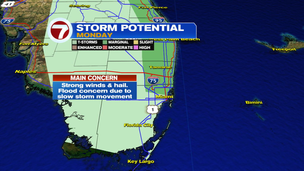
And those weather changes will begin on Monday. Moisture will increase across our area ahead of our next Front (yes, another mid-April Front) and this will increase our rain and storm chances throughout the day on Monday. Monday should start off dry and steamy but storms will begin to ‘pop’ just afternoon lunch time. And some of the storms that develop have the potential to be strong to severe. While strong winds and hail look to be the main threats Monday, flooding could also be a concern due to the slow movement of storms.
The front looks to push through South Florida on Tuesday and even though we are not expecting any major cooling with this front, we will FEEL the difference as we round the corner into the second half of the work week where humidity levels begin to drop a bit. Our afternoon high temperatures during this time will be in the mid to lower 80s (which is actually near-normal for some) so it will actually bring some relief this time around. The breeze will also pick up during this time so temperatures, although warm, will not feel uncomfortable. Showers return once again by the end of the work week.
Have a wonderful day!
Erika Delgado
Meteorologist
WSVN Channel 7 News
Copyright 2024 Sunbeam Television Corp. All rights reserved. This material may not be published, broadcast, rewritten or redistributed.