Happy Sunday, South Florida!
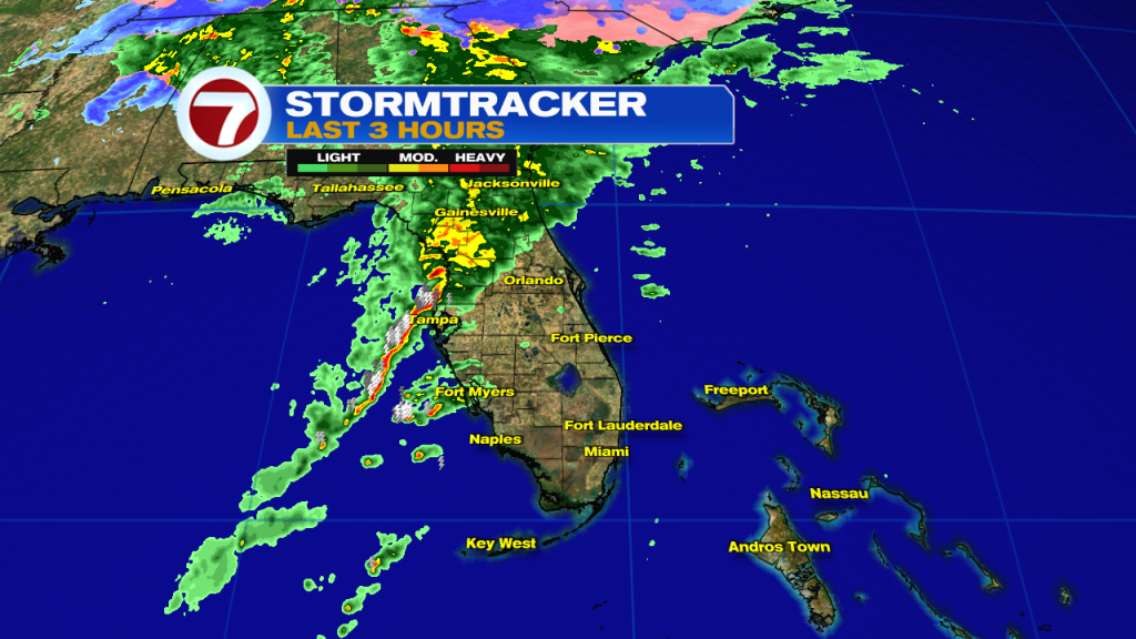
Hopefully everyone had a nice start to the weekend as we saw beautiful conditions throughout the day on Saturday. But as I mentioned yesterday, all good things do come to an end and it looks like the nice conditions we had the last two days have moved out of our area as more changes are headed our way. And we already began to feel those changes early this morning as temperatures were milder across South Florida mainly in the upper 60s to low 70s. We woke up to a stronger south wind ahead of a front that will reach us later today. But before the front arrives, a line of thunderstorms will push through South Florida.
As mentioned above, there are changes they’re already taking shape across our area. So there are good news and bad news to what we can expect today. The bad news is that our new southerly wind direction has already prompted a brief warming trend across south Florida. The reason for our change in wind direction? This is due to the fact that there will be another [stronger] Front that will be pushing through our area later today.
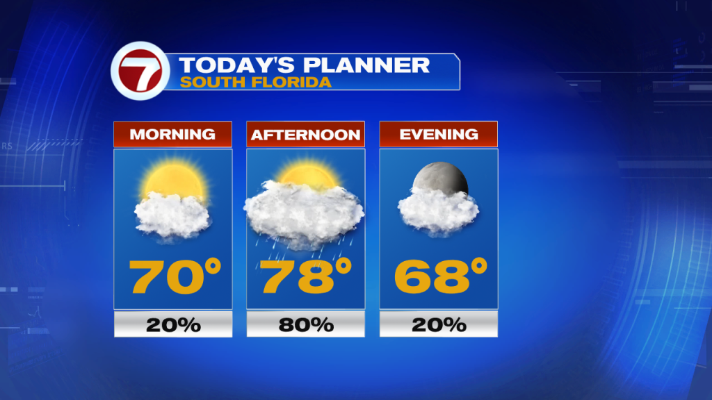
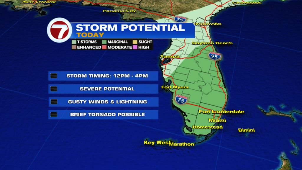
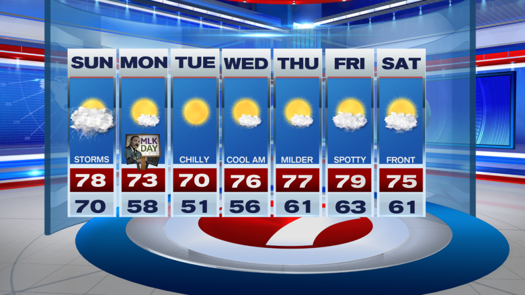
More importantly, we can expect a line of thunderstorms early in the afternoon. Some of those storms could even turn strong to severe, With the main threats being lightning, very gusty winds and of course we can never rule out a brief tornado or two. The good news is that once we get through this mild and stormy weather today, another cool down is expected for South Florida and we will begin to feel that cooldown by this evening.
Looking ahead, Monday (which happens to be MLK day), cooler and drier air will begin to move in throughout the day. Behind today’s strong front, some clouds may linger early in the day on Monday but then clearing skies and cooler weather begins to move in. That means starting Monday morning through at least the middle of the work week temperatures will be in the 50s once again. The majority of next week also shows afternoon high temperatures remaining in the 70s. As of now, Tuesday looks to be the coolest day of the week as our morning temperatures drop into the upper 40s and low 50s while our afternoon high temperatures will struggle to even hit the lower 70s. So if you like the cooler weather, the only “bad day“ looks to be today!
Remember to stay weather alert today!
Erika Delgado
Meteorologist
WSVN Channel 7 News
Copyright 2024 Sunbeam Television Corp. All rights reserved. This material may not be published, broadcast, rewritten or redistributed.