

Happy Sunday, South Florida!
Hopefully everyone was able to enjoy the start of the weekend as very few portions of South Florida saw rain yesterday (except for Broward where rainfall totals reached over 2″ late last night). Conditions outside we’re actually quite comfortable even though our afternoon high temperatures remained above average. This morning South Florida woke up to more clouds, fog and mild temperatures in the upper 60s. It is evident that a front is over our area and, as mentioned on Saturday, the front looks to have stalled over our area.
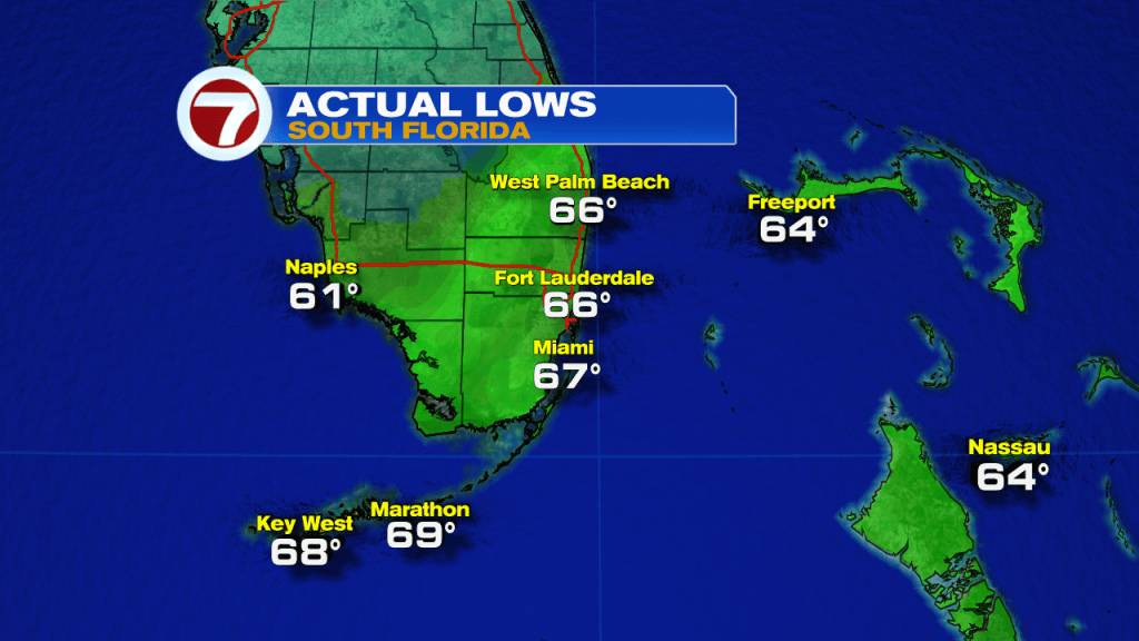
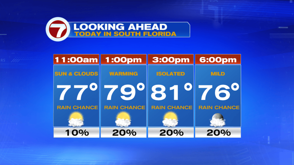
Today we can expect a few isolated showers through the afternoon and early evening hours, however, the chance for rain will still remain on the lower end. Clouds may linger on and off throughout the day especially since the front will remain over our area for the remainder of the weekend. As expected, no cooling will come with this Front. Our afternoon high temperatures will once again reach into the lower 80s as we have been seeing in previous days.
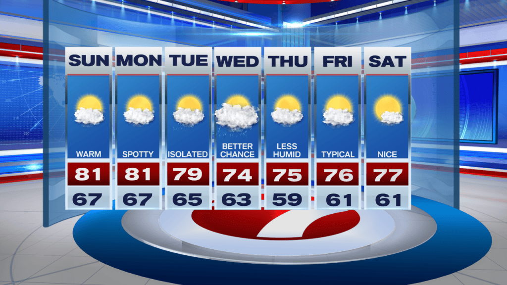
Looking ahead, this stubborn front looks to stick around across South Florida until at least the middle of the upcoming work week. A few showers will be possible each day but by no means are we expecting a washout. However, by the middle of next week another front will begin to push across our state and that will finally wipe away all the moisture, humidity and the warmer temperatures out of our area. That means that our cooler and drier air will once again return to the forecast by the end of the workweek. Temperatures by Thursday and Friday morning could possibly reach into the 50s once again.
Have a great afternoon!
Erika Delgado
Meteorologist
WSVN Channel 7 News
Copyright 2026 Sunbeam Television Corp. All rights reserved. This material may not be published, broadcast, rewritten or redistributed.