Typical summertime pattern will remain in place over South Florida over the next couple of days. This translates to spotty morning showers favoring the metro and coastal areas during the late morning through mid-afternoon hours.

Along the sea breeze, the bulk of the moisture will move inland by late afternoon through the early evening hours. There is the potential for brief gusty winds and downpours with the development of strong cells.
This pattern looks to stick around for much of the work week.

Models are hinting at the return of Saharan Dust by the end of the work week. As this drier air moves in, expect our rain chances to be lower, but not be eliminated on Friday. Rain chances will return to isolated with hazy sunshine into the start of the weekend.
TROPICS
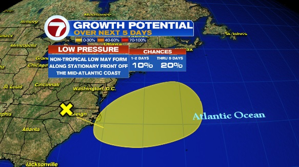
An area of low pressure is likely to form on Wednesday along the coast of North Carolina. This feature is currently over land, but it could develop tropical traits as it moves over the Atlantic waters. The National Hurricane Center is giving it low over the next 5 days.
Copyright 2024 Sunbeam Television Corp. All rights reserved. This material may not be published, broadcast, rewritten or redistributed.