Scattered showers and storms will close out the weekend in South Florida. The influx of tropical moisture is courtesy of an upper low over the Gulf of Mexico. Winds out of the southwest will push the wet weather from inland to the coast as the day progresses.
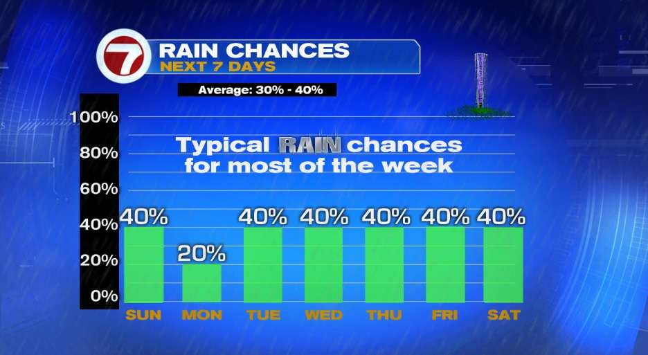
Once the upper low exits, slightly drier air will work its way back South Florida on Monday.
High pressure working its way back over the area will bring the return of a typical summer pattern of morning coastal and metro showers and afternoon/early evening storms in the forecast from Tuesday through next weekend.
ACTIVE TROPICS
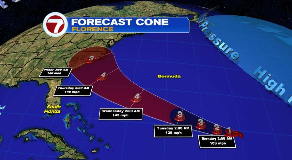
#1 Several hundred miles southeast of Bermuda, Florence is expected to become a major hurricane on Monday. Those from North Florida to North Carolina should keep a close eye on Florence, especially by the latter part of next week. Hurricane preparations should be in place.
** Large swells affecting Bermuda and portions of the U.S. East Coast will continue this week. These swells will result in life-threatening surf and rip currents.
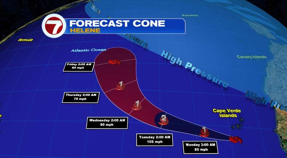
#2 Expected to become a hurricane later on Sunday, Helene has prompted a Hurricane Watch and Tropical Storm Warning for portions of the Cape Verde Islands. In the days ahead, this system looks to veer more out into the open Atlantic waters.
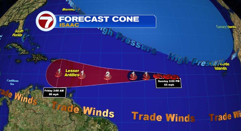
#3 Issac is expected to strengthen in the days ahead as it moves over warm waters and a zone of low wind shear. Expected to become a hurricane on Monday, the latest cone suggest Issac will impact the Lesser Antilles & possibly Puerto Rico.
Copyright 2024 Sunbeam Television Corp. All rights reserved. This material may not be published, broadcast, rewritten or redistributed.