

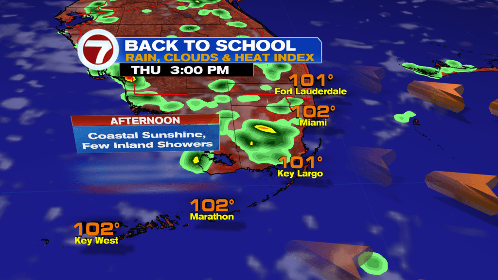
The forecast is calling for a warm and muggy start with mostly dry conditions. There is only a small chance of seeing an isolated shower. By the afternoon between 2-3pm, temperatures will climb into the low 90’s and feel like the 100’s. An inland storm possible.
Today in the Tropics
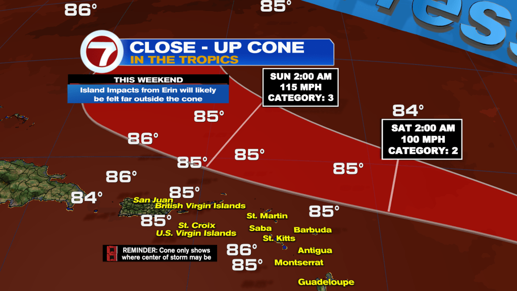
Tropical Storm Erin continues moving Westward and forecast to become the first hurricane of the season by Friday.
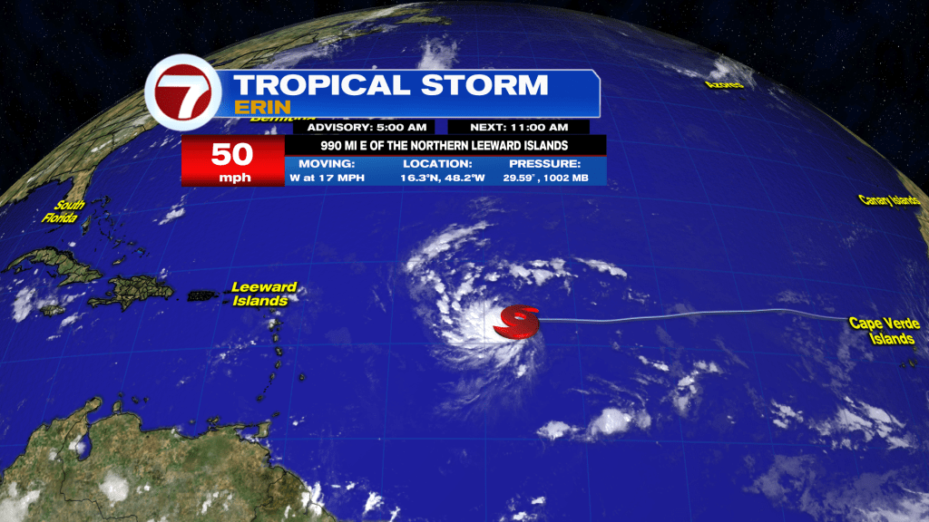
Erin will likely become a major hurricane on Sunday as it moves at a slower pace to the West-Northwest. On the forecast track, the center of Erin is expected to move near or just North of the Northern Leeward Islands over the weekend.
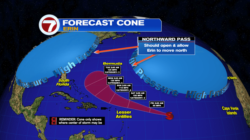
Erin will find a gap between two areas of high pressure that will allow it turn Northward. Model guidance is insisting this will happen, but how fast that happens is key whether or not Erin gets closer the East coast of the United States. A lot of things can change and that is why we will continue to monitor it closely. Right now, the worry meter for South Florida remains low.
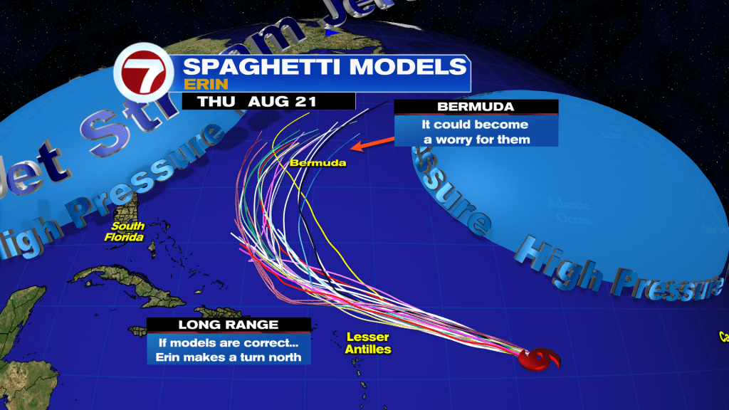
Erin will rapidly intensify as it gets closer to the islands. However, the magnitude of the impacts are still unknown since it is still far away.
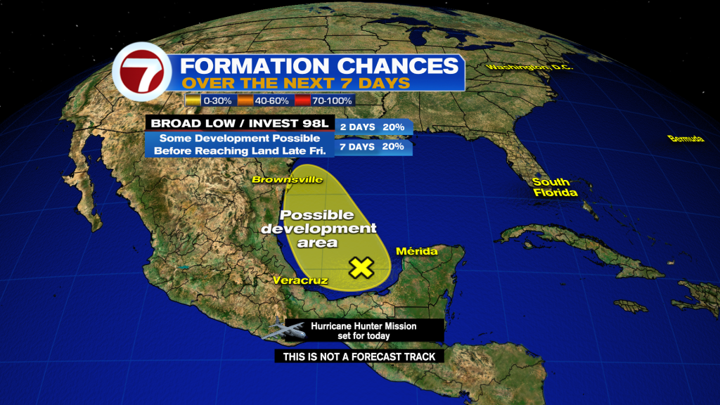
Broad low pressure has emerged into the Bay of Campeche. It has small window to organize before it moves onshore on Friday between Northeastern Mexico and Southern Texas. Heavy rains to spread across these areas.
Have a wonderful day South Florida and make it a safe one!
Vivian Gonzalez
Meteorologist, AMS Certified