(WSVN) - Following a stunning start to the long holiday weekend with a good amount of sunshine through much of the day and mostly dry weather, more of this good weather is in store today into Memorial Day overall.
A bit more in the way of moisture is streaming in this Sunday morning and this will be the case over the next 24 hours or so. This is resulting in a show of showers streaming onshore across parts of South Florida this morning.
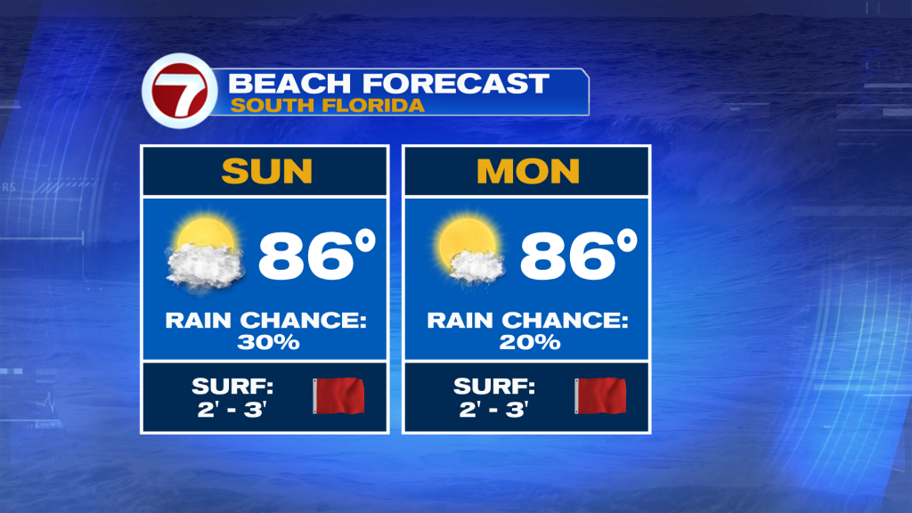
Therefore, expect some soggier spots, mainly this morning, before that activity tends to wane during the afternoon hours. Other areas will be looking at passing clouds and sunshine throughout the day Sunday paired with highs generally in the upper 80s.

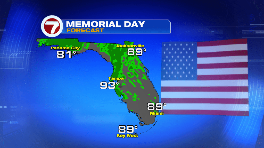
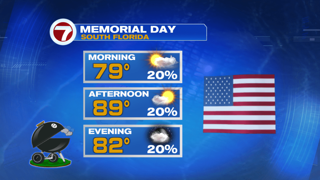
On Memorial Day, drier air will start to settle in overall but the occasional, spotty shower cannot be ruled out. Overall, expect sunshine and a few clouds Monday while highs hold steady in the upper 80s. Feels-like temperatures will be about 10F higher, however, given the tropical humidity levels.
At least we’ll have a breeze, which will increase some more Sunday into early this coming week. Sustained winds will be in the 10-20 mph range while gusts reach 25-30 mph for most locations these next few days.
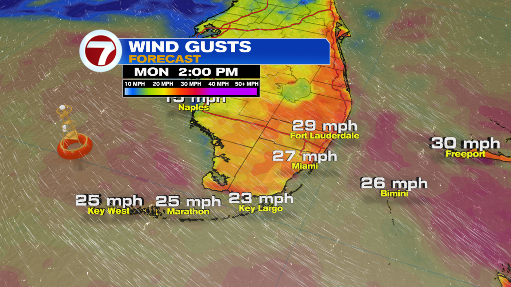
That will keep the rip current risk at our east coast beaches high.
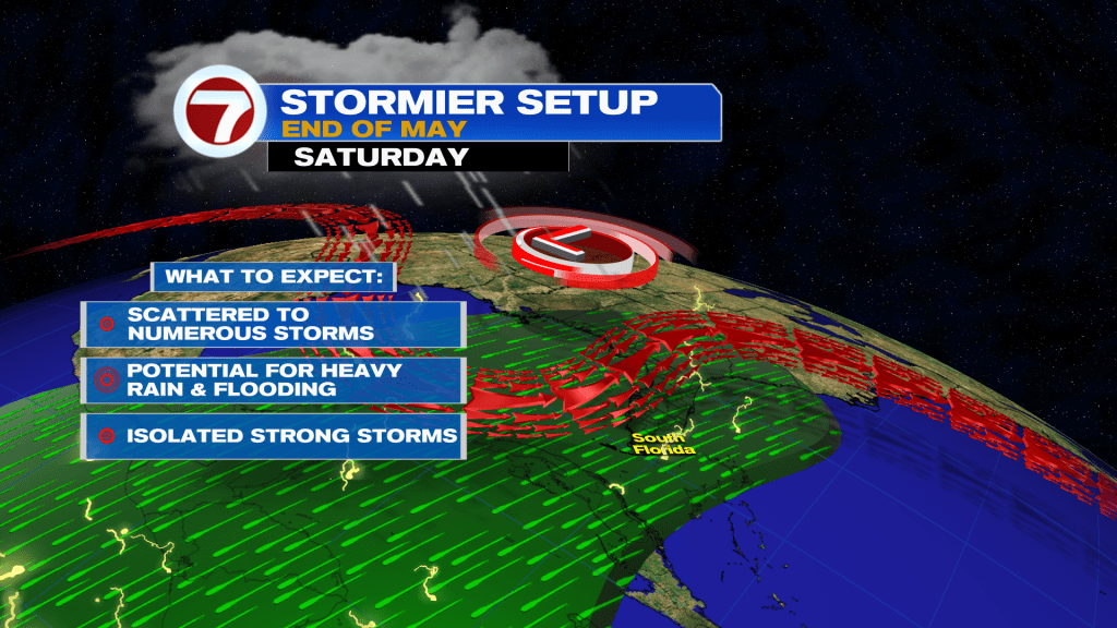
Looking ahead to the long range, rain chances do rise starting Wednesday and especially on Thursday as beyond as plumes of tropical moisture are expected to get drawn northward from the Caribbean Sea.
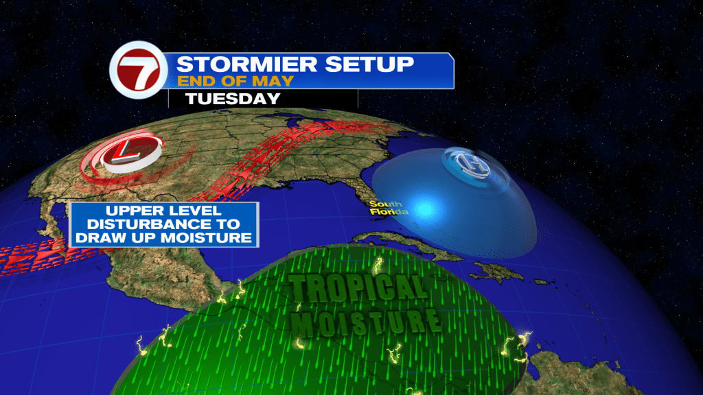
This is expected to lead to a stormy and unsettled weather pattern with the daily risk for scattered to numerous showers and storms. That will come with the potential for areas of flooding and some stronger storms.
Copyright 2026 Sunbeam Television Corp. All rights reserved. This material may not be published, broadcast, rewritten or redistributed.