We will see both seasons all rolled up into one weekend.
These next 48 hours will see warm and muggy conditions with a chance for spotty rain, then followed by cool and sunny on Sunday.

A “Fall Front”, more cool than cold, will be making its way over South Florida on Saturday.
We can expect some spotty rain moving in between 2 – 5 am, with an isolated downpour by afternoon.
Temps will remain on the warm side at least until the front clears.
 On Sunday, the Fall Front pushes into Cuba, and we begin to enjoy the fresh air across the region.
The skies will be a delightful Fall Blue hue, with a nice northerly breeze between 10 – 15 mph. The humidity levels will be almost nil making the temps feel that much nicer.
If you like this kind of weather, you’re in for a treat as local temps will be a little cooler on Monday.
Next 7 Days Lows
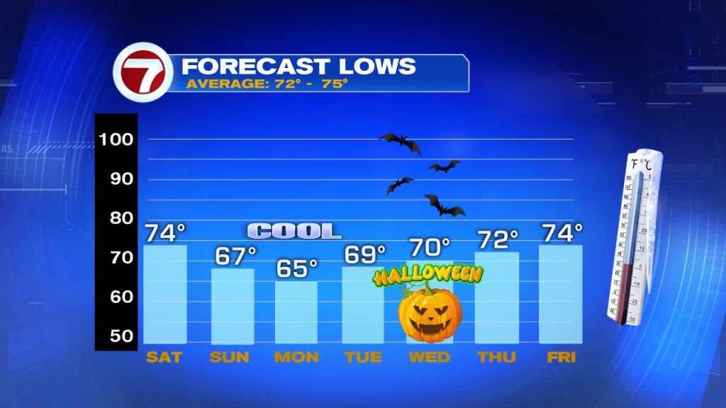
The weekend starts out pretty seasonal with lows in the mid 70s. On Sunday, the wake up temp is 67°, and by Monday, a nice 65°, with cooler temps across the western suburbs. We slowly start to warm back to average on Tuesday.
Big Nor’easter Brewing
We are following two low pressure systems.

- The first low is anchoring the front bringing us the cooler weather.
- The second is sitting across the Pacific Northwest.
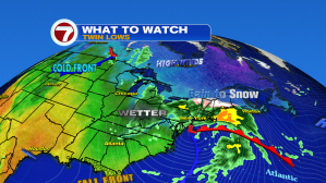 The first Low will travel north causing a Nor’easter, (So called because the winds tend to blow in from the Northeast) with rain, some snow, and very windy conditions.
It will be a fast mover clearing the area by Sunday night, unfortunately it will take up much of the weekend for folks in the Mid Atlantic States and the New England.
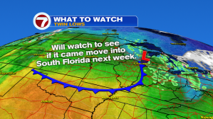
The second low also has a front attached to it. The jet stream will continue to push it east. The question will be whether it will have enough legs to make it all the way to South Florida.
Some of the models hint at maybe arriving late next week or maybe for the weekend. If it does, we could see the return of cool weather.
Wet Weekend

Our in-house model is forecasting anywhere between a trace of rain for Atlanta, to as much under 2 inches across Syracuse, Baltimore, and Charlottesvile.
Tropical Action
As of late Friday night, NHC started issuing advisories on Subtropical Storm “Oscar”.

It is not well organized with most of the cloud cover, rain and gusty winds, on the eastern half of the storm.

It may become fully tropical on Saturday as it stays trapped between two high pressure systems. Eventually Oscar will get steered north into the Northern Atlantic. Bermuda should keep an eye out just in case, although it will have a very difficult time keeping its act together fighting the highs and approaching front. As of this moment, NO THREAT to any land areas.
What is a Subtropical Storm?
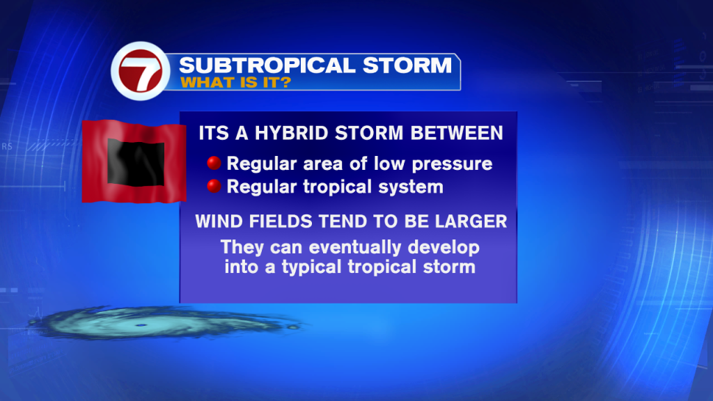
This is the classification NHC gives a system that is not quite a hurricane and not quite a regular low pressure. It’s a hybrid with a warm core. If it can turn that core into a hot center, it will then become fully tropical. That’s what we’ll be watching over the weekend.