The sky has been very mixed lately. On Tuesday, dark storm clouds gave way to some nice clearing by the late afternoon. Here’s a beautiful view of Biscayne Bay with calm waters.

Call it the “calm after the storm”. Earlier in the day, the satellite and radar confirmed the presence of more active weather. Some of the showers and storms were on a crawl (and remained stubborn, in spots).

As we often see during the summer season, rain amounts ran the gamut with the heaviest amount being 3-inches. That was over Coconut Creek where some roads (including W Sample) were impassable due to standing water!

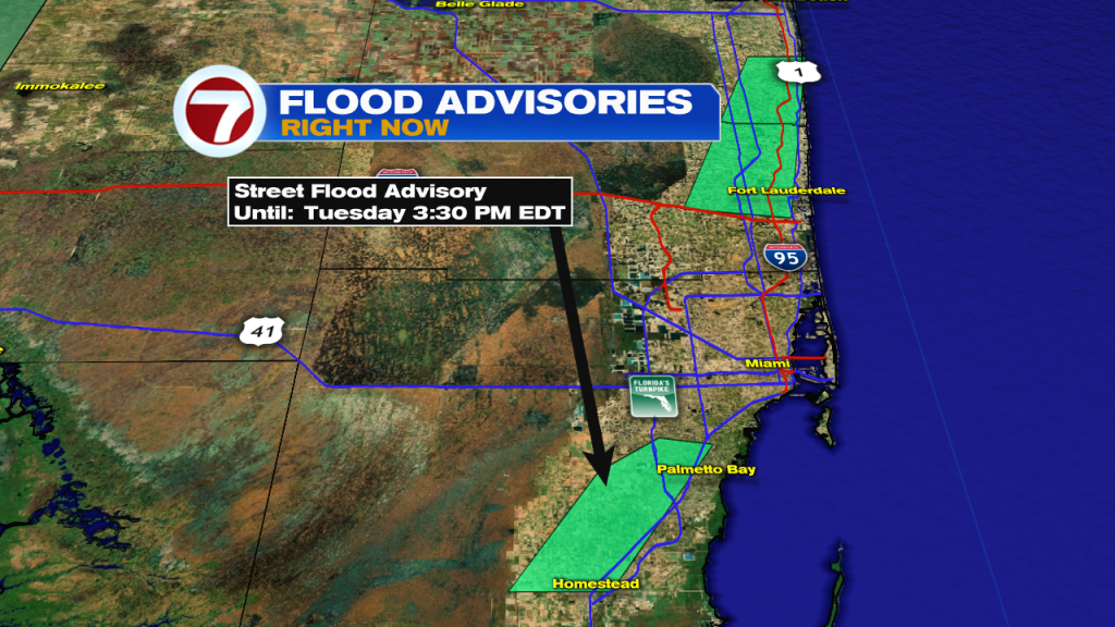
Street Flood Advisories (Tuesday afternoon) included northeastern Broward County and southeastern Miami-Dade. Into the early evening, a portion of the Lower Keys also got a flood alert. It was between mile marker 16 and 22 where slow-moving downpours continued.
Looking into Wednesday, the weather map looks “standard” for this time of the year. Steamy air will translate into scattered storms, probably favoring inland locations due to the clashing sea breezes.

It’s worth noting that it’s Back to School in Broward! Typical weather can be expected and could slow down the traffic lanes, including school buses during the trip home.

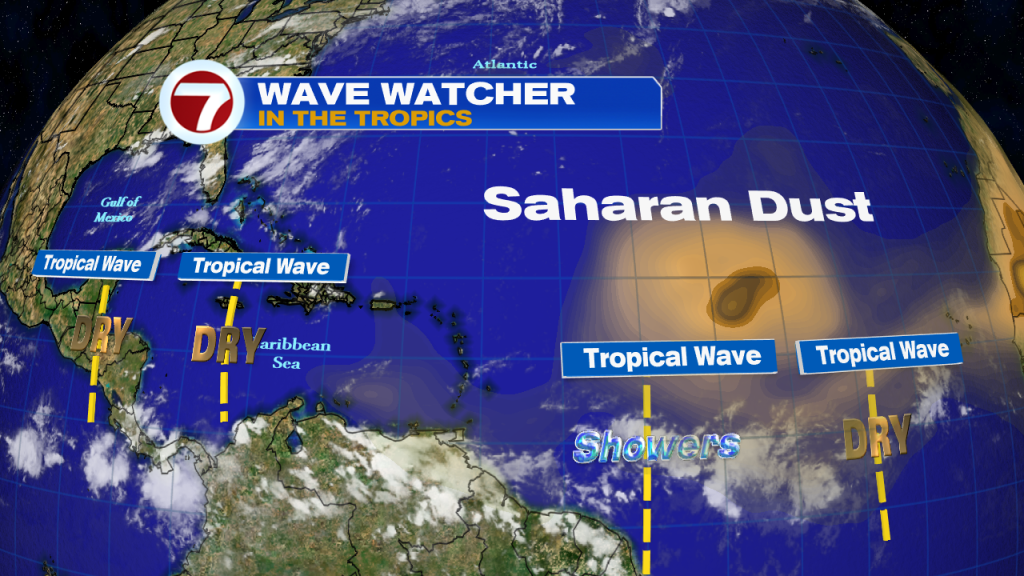
As for the Tropics, which are usually perking-up in August, we’re only seeing weak tropical waves. None of these is showing development potential through the rest of the week or foreseeable future. There’s still a large amount of Saharan Dust over part of the Atlantic Ocean. The dry air prohibits tropical systems from forming. Instead, actual systems need ample moisture with persistent thunderstorms (also, favorable winds and warm waters are necessary).