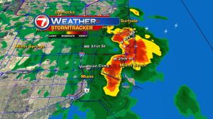
It’s a stormy start to the new week. Rounds of heavy rain and thunderstorms started flaring up on Labor Day, due to a moisture boundary sitting over south Florida. With steamy tropical air and abundant moisture (at a maximum), we’ll need to be on the watch for additional downpours through Tuesday afternoon and evening. Meanwhile, winds remain light. The weak steering motion over rain will mean more sluggish-moving activity. There are also several air circulations swirling over the region keeping things unsettled. By Wednesday (and the midweek in general) we’ll likely see a stronger ocean breeze. Once that happens, the potential for daytime storms will decrease near the coast… and be more focused over interior south Florida. Looking ahead, another batch of deep moisture appears to be shifting our way for the long range. By Friday, this surge in “storm fuel moisture” could provide more numerous showers again, over the region.


