Happy Sunday, South Florida!
Hopefully everyone got to enjoy the sunny and steamy conditions that we saw through most of Saturday. The afternoon thunderstorms that we were expecting turned out to be a bit more delayed and developed out west then moved over our metro areas through the evening hours. Up until then, South Florida got to enjoy picture perfect conditions. This morning we woke up to warm and muggy conditions, mostly cloudy skies and with temperatures in the mid to upper 70s. Meanwhile, the FL Keys started off with a few showers and thunderstorms.
Due to the southerly wind flow still in place, moisture will continue to be funneled into our area. This means that the moisture available for rain will remain high. So throughout the day today expect scattered showers and thunderstorms across South Florida. And while it’s not expected to be a washout of a day, it would be wise to keep the umbrella nearby in case you encounter rain as we are expecting thunderstorms to develop across our metro areas once again this afternoon.
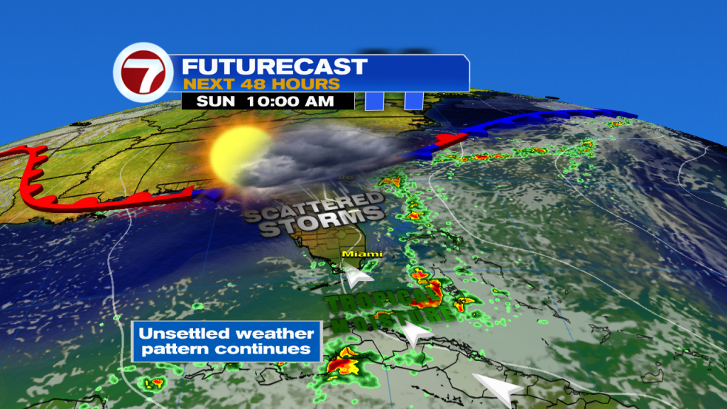
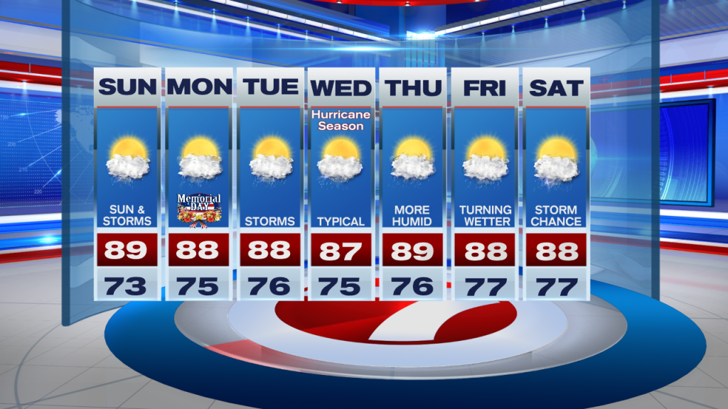
Looking ahead, the unsettled weather pattern continues into the start of next work week, which happens to be Memorial Day. Rain (heavy at times) and scattered slow-moving thunderstorms will be possible once again. High temperatures will remain in the upper 80s under very humid conditions. As we fast forward to the middle of the work week, our rain chances will be a bit more typical and seabreeze driven each afternoon. And after a few days of enjoying a typical weather pattern here in South Florida, it looks like moisture may actually increase once again as we round the corner into the end of the upcoming work week.
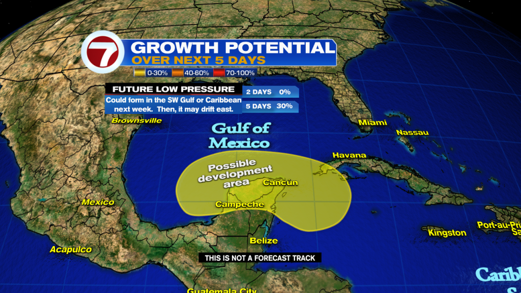
Shifting gears, while the Atlantic hurricane season officially begins on Wednesday, June 1st, the National Hurricane Center is already keeping a close eye on the Tropics. Remnants of Hurricane Agatha (the Pacific’s first named storms of the season) could reemerge in the SW Gulf of Mexico and/or the NW Caribbean. If it holds together, then an area of low pressure could develop and then slowly drift East to Northeast later in the work week. We will have to monitor the Tropics in the next few days.
Have a safe holiday weekend!
Erika Delgado
Meteorologist
WSVN Channel 7 News
Copyright 2024 Sunbeam Television Corp. All rights reserved. This material may not be published, broadcast, rewritten or redistributed.