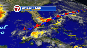
A weak front stretched-out across south Florida help spark more couple rounds of rain with storms (again) on Tuesday. The boundary appears to be “on its last leg” and we’re expecting it to fizzle out, early Wednesday.
As high pressure builds (off the Mid Atlantic states) we’ll return to an onshore flow. The better steering winds should send any developing daytime storms off toward the Gulf side of the state.
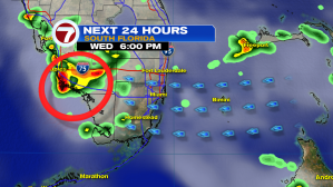
It’s a turn in weather timing, as the week continues. Unlike previous days which started rather hot and ended stormy, we’ll revert to a classic pattern of morning clouds and some random rain bands. After that, storms will focus on areas from the Everglades toward the southwest coast, deeper into the day. Expect plenty of lingering heat and humidity across the region. That could even build during the weekend as winds turn more out of the south and temperatures rise to around 90-degrees.