Happy Sunday, South Florida!
Hopefully everyone has had a nice start to the weekend so far. Saturday started off mainly dry for South Florida until a few inland areas saw showers and thunderstorms. Some of these storms were on the stronger side as they produced heavy downpours, lots of lightning and gusty winds at times. This is a big change after seeing quite a few days with dry conditions last week. This morning we woke up to dry and quiet conditions once again but that won’t be the case through the entire day.

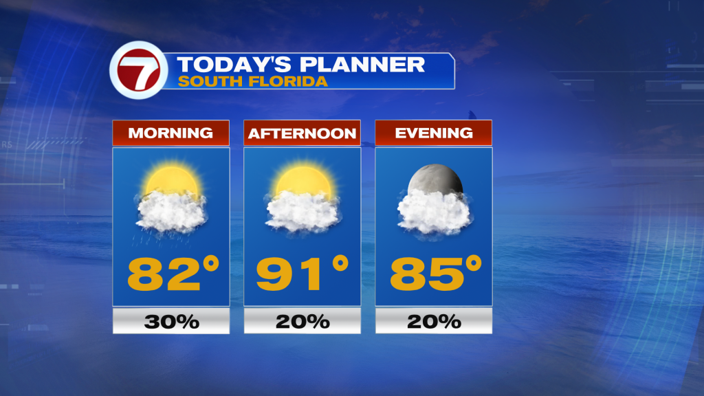
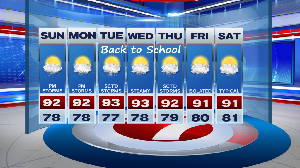
Today promises the return of showers and afternoon thunderstorms as our wind pattern veers out of the South and then out of the Southwest. A weak front is forecast to stall over northern sections of our state and this will cause the change in our wind pattern. That means that while South Florida will see plenty of dry time through the first half of the day, afternoon thunderstorms will be focused across the East Coast. That means a stormy afternoon is expected for us today after high temperatures reach into the lower 90s. So if you have outdoor plans today, be sure to keep that rain gear close.

Looking ahead, our wind pattern will remain out of the Southwest (to even west at times). This will steer afternoon thunderstorms towards the East Coast each day. And it looks like this wind pattern and stormy weather setup will stick around through at least mid-week. This is especially important since kids will be going back to school this week! So be sure to pack those umbrellas in school backpacks! Our wind pattern begins to change once again by the end of the week as high pressure builds across our area. That means our typical weather pattern (morning showers, inland storms) returns and sticks around through next weekend.

Have a great afternoon!
Erika Delgado
Meteorologist
WSVN Channel 7 News
Copyright 2024 Sunbeam Television Corp. All rights reserved. This material may not be published, broadcast, rewritten or redistributed.
