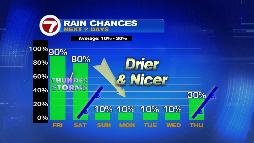
An active period of weather is in store for all of South Florida this Friday into Saturday as a large storm system moves across the Gulf coast states then up the eastern seaboard of the US.
A closer examination of our setup shows a secondary area of low pressure farther south over the Gulf of Mexico this Friday morning, which is forecast to track across South Florida tonight into Saturday morning. This should help instigate the risk for heavy rain and strong storms.

Numerous weather threats will be present through tomorrow. This includes a Wind Advisory in effect for coastal and metro Miami-Dade and Broward Counties from noon Friday through 8PM Saturday for gusts up to 40 mph. The strongest of the winds likely peaks tonight.

A Flood Watch is also in place for all of the area through Saturday afternoon and evening with up to 2-5 inches of rain possible. Current model guidance suggests the heaviest of the rainfall totals occurring across our southern locations, including the Florida Keys.

In addition to the rain and flood risks, there is also the low chance for severe storms. The best chance for strong storms through tomorrow will also be across southern South Florida with isolated tornadoes, damaging winds and hail all possible.

As far as timing of this rain is concerned, it’s going to be fairly soggy with a light rain and lots of clouds through around midday Saturday. Within this steady, persistent rain or drizzle will be rounds of heavier rain and lightning. This is when flooding and severe weather concerns will elevate.
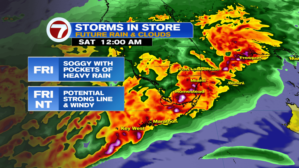
These more hefty rounds of storms will be possible through midday Saturday before activity tapers off by Saturday evening, giving way to sunshine and much better weather for the second half of this weekend.

Early to mid next week will be very nice with sunshine, high temperatures near normal in the low 80s and variable low temperatures ranging as low as the mid 60s Sunday and Monday mornings to around 70F for the middle of next week.
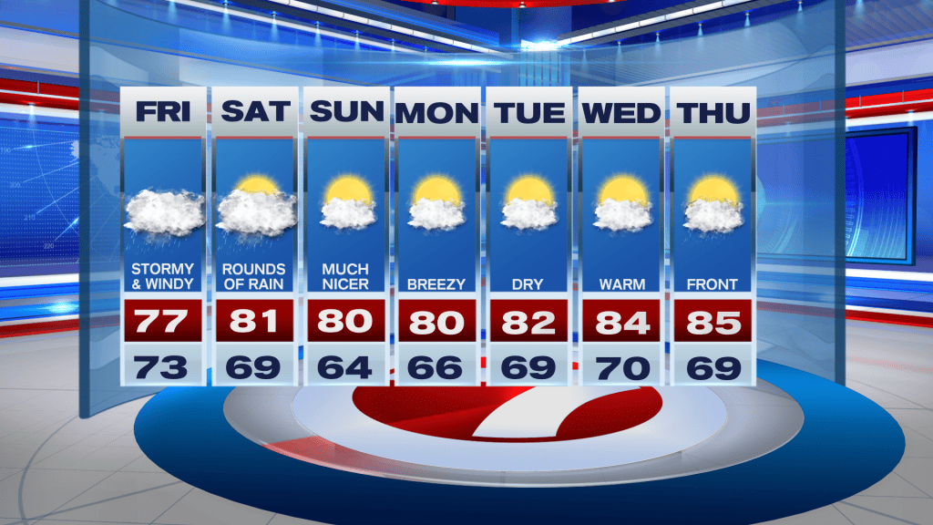
The next chance for rain arrives with another front on Thursday, but this does not look to be a significant system — at least as of now.