Happy Saturday, South Florida!
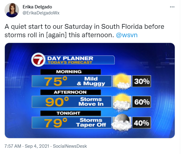
Hopefully everyone had a great week and a great first few days of September. After a quiet start to the workweek, the end of the week transitioned into a more stormy weather pattern for us. And while our mornings have started off on the quiet side, our afternoons have been quite active. This morning we already woke up to quiet conditions so for now, it looks like the weather pattern may remain the same.

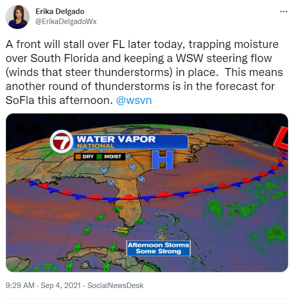
Remember Hurricane Ida that pushed through the Northern Gulf Coast and flooded not only the caused devastating damage there but also flooded the Mid-Atlantic States and the Northeast earlier this week? Well the leftover moisture from Ida has stuck around across Florida and has continued to help bring heavy rain across our area. A front across northern & central sections of our state is helping to trap that moisture over us. That, together with a westerly steering flow (the winds that steer thunderstorms), will help keep a soggy and stormy weather pattern for South Florida.
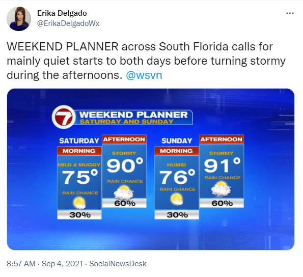
So today will be a lot like what we saw on Thursday and Friday. The day should start off rather quiet with only some clouds around and maybe a shower here and there. But as we head into the afternoon, thunderstorms will favor interior sections of South Florida and the East Coast once again. Some of these thunderstorms could be on the stronger side. And some of these thunderstorms could produce very heavy rainfall, as we have been seeing in previous days. Temperatures will remain average in the lower 90s.
The latter part of the weekend looks to remain about the same. With no major change across South Florida, we can expect another round of afternoon thunderstorms to favor the East Coast once again. That means that if you have any outdoor plans this weekend, it may be best to move them to the morning hours. Outdoor plans in the afternoon should be moved indoors. With a West to Southwest wind in place, afternoon temperatures will warm quickly into the lower 90s.
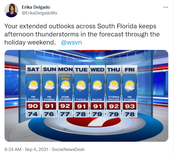
While the Labor Day holiday looks to remain stormy during the afternoon once again, South Florida should begin to notice slightly fewer storms in the forecast. And by the middle of the work week, a typical weather pattern in South Florida should return where afternoon thunderstorms will once again favor the West Coast of Florida. And after a few days of going back to normal around here, it looks like South Florida MAY go back to these stormy afternoons as we head into the end of next week.
Have a great weekend!
Erika Delgado
Meteorologist
WSVN Channel 7 News
Copyright 2024 Sunbeam Television Corp. All rights reserved. This material may not be published, broadcast, rewritten or redistributed.