Happy Sunday south Florida!
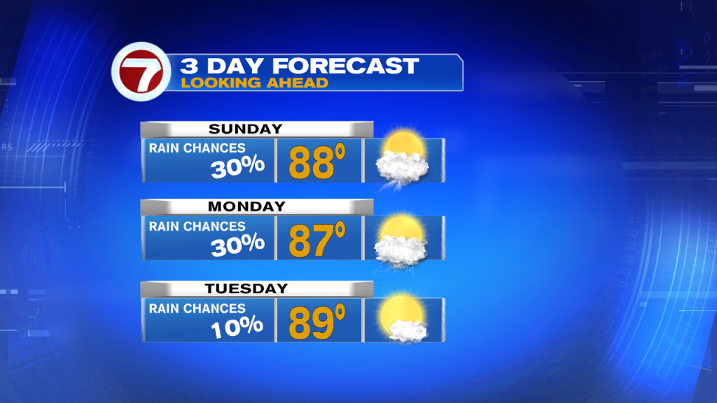
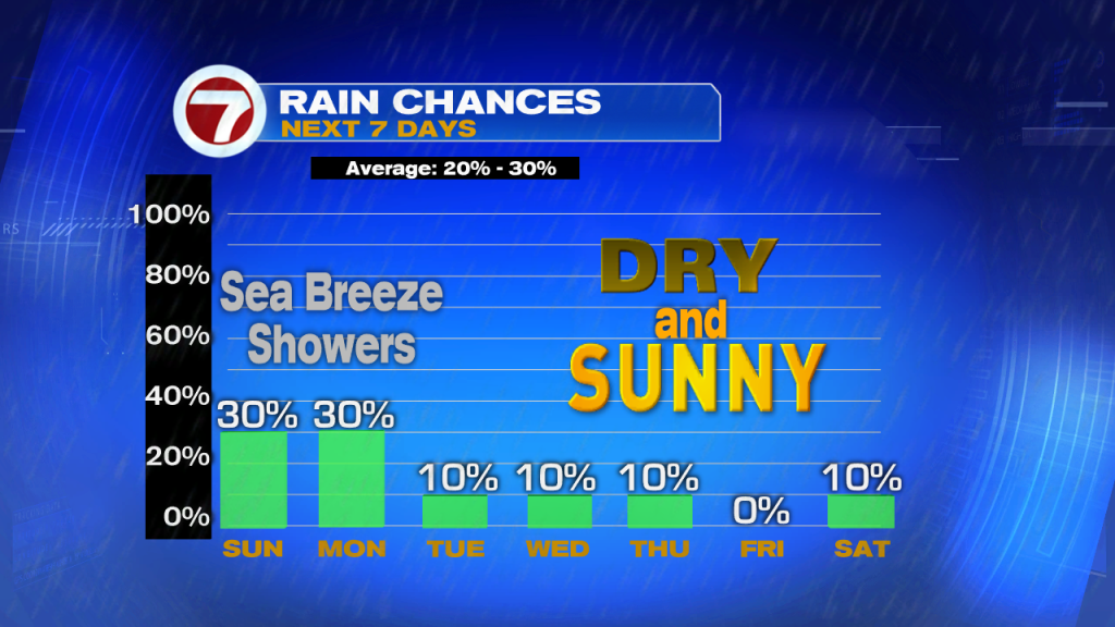
It’s going to be a beautiful day. Mostly dry this morning with isolated storms inland this afternoon…typical sea breeze pattern. Nice and warm, highs in the upper 80s. A bit breezy along the coast with an onshore flow keeping the risk of rip currents in the forecast.
Gorgeous day ahead south Florida!
Get out there and enjoy my friends. pic.twitter.com/OslV2XLaVX— Felicia Combs (@FeliciaCombsTWC) May 19, 2019
For Monday, a few morning coastal showers and isolated inland storms with the sea breeze. Highs in the upper 80s with a mix of sun and clouds. Continued risk of rip currents.

Even drier air builds in for Tuesday keeping a lid on rain chances.

High pressure has a strong hold on our weather and helps to keep a low pressure system moving away from our area.

The National Hurricane Center is giving that disturbance a medium chance of development near Bermuda in the next couple days. Regardless of development this won’t impact south Florida.
A disturbance is expected to form southwest of Bermuda early next week. The low has a medium chance of development in the next 5 days although models don't look impressed with it. This poses no threat to south Florida. pic.twitter.com/xGhjAqNEET
— Felicia Combs (@FeliciaCombsTWC) May 19, 2019
Next week will be mostly dry, sea breeze pattern persists with near normal temperatures in the upper 80s. Winds pick up midweek and remain gusty.

Have a wonderful weekend!
-Meteorologist Felicia Combs
Copyright 2024 Sunbeam Television Corp. All rights reserved. This material may not be published, broadcast, rewritten or redistributed.
