Happy Tuesday, South Florida!
Hopefully everyone enjoyed the ‘drier’ start to the work week,…especially after over a week of flooding rain across South Florida. There are a few reasons for this ‘drier’ change and one of the reasons is that a layer of Saharan Dust has moved over our area and limited rain chances on Monday. This morning was no different. We enjoyed quiet conditions while our temperatures started off on the warm side. Overnight temperatures remained in the lower 80s while our feels-like temperatures were already in the lower 90s early this morning.
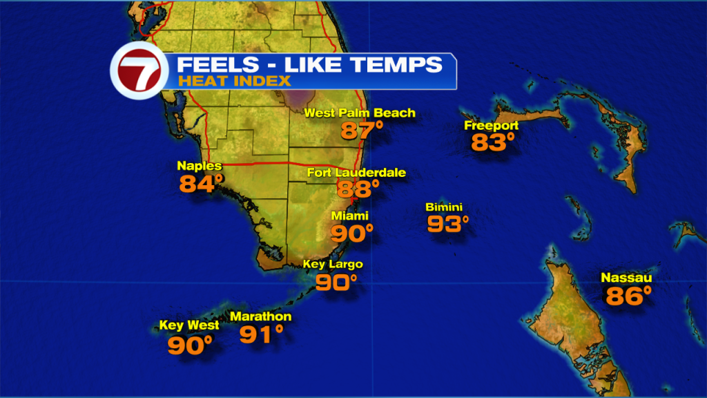
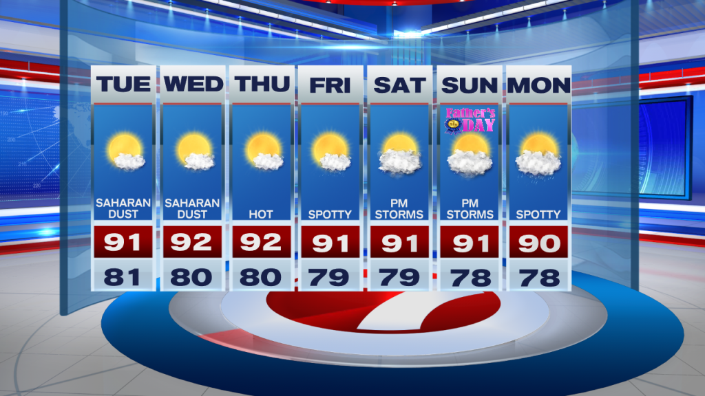
Today will be a lot like Monday as far as the heat and rain potential. A layer of Saharan dust has moved over South Florida and that will limit rain potential across our area today. That’s not to say that we will be dry all day as a few showers will still be possible, especially through the first half of the day and across the FL Keys. Our afternoon high temperatures will reach into the lower 90s but with the added humidity in place, our feels-like temperatures will be in the 100s. It is probably best to keep hydrated if spending any significant time outdoors.

Looking ahead, drier days continue through at least the middle of the work week as Saharan dust remains nearby and while our wind pattern out of the Southeast continues to push showers inland and out west. As we fast forward into the upcoming weekend, a weak front will enter Northern Florida. This will help trap moisture across South Florida while our wind pattern veers out of the Southwest once again. This will help push any thunderstorms that do develop towards the East coast in the afternoon for the all important Father’s Day weekend.
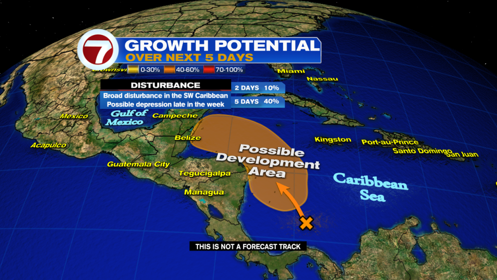
A quick check on the Tropics….the National Hurricane Center is keeping an eye on a disturbance in the SW Caribbean producing disorganized showers and thunderstorms. As the disturbance meanders to the Northwest, some development of this system will be possible through the rest of the week (especially if it stays over water). If so, a tropical depression may form late this week. Regardless of development, heavy rain is expected across Honduras and Nicaragua.
Have a great afternoon!
Erika Delgado
Meteorologist
WSVN Channel 7 News
Copyright 2024 Sunbeam Television Corp. All rights reserved. This material may not be published, broadcast, rewritten or redistributed.