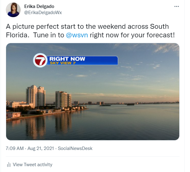
Happy Saturday, South Florida!
Hopefully everyone had a great work week! If you like it dry and hot, then you must have liked what this past week had to offer us. We enjoyed steamy temperatures in the 90s, plenty of sunshine and very little rain. It wasn’t exactly what we call a ‘typical’ summer-like weather pattern around here but since we’re always used to afternoon thunderstorms during the summer, this was a welcomed change for many. And this morning was no different. South Florida woke up to mainly dry conditions and mostly clear skies.
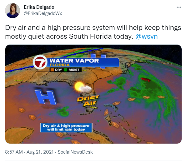
Two key weather factors have been keeping things quiet across South Florida through the past few days. For one, South Florida has enjoyed lots of dry air in the mid and upper levels of the atmosphere. That’s what helped give us those beautiful blue skies. But also, a strong high-pressure system has also helped keep our atmosphere on the stable side and not allow for any storm systems to move through our area. Together they have given us a few beautiful Summer days.
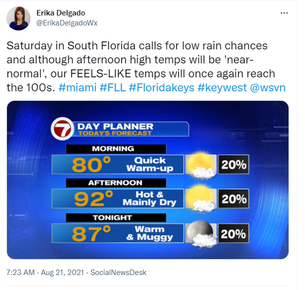
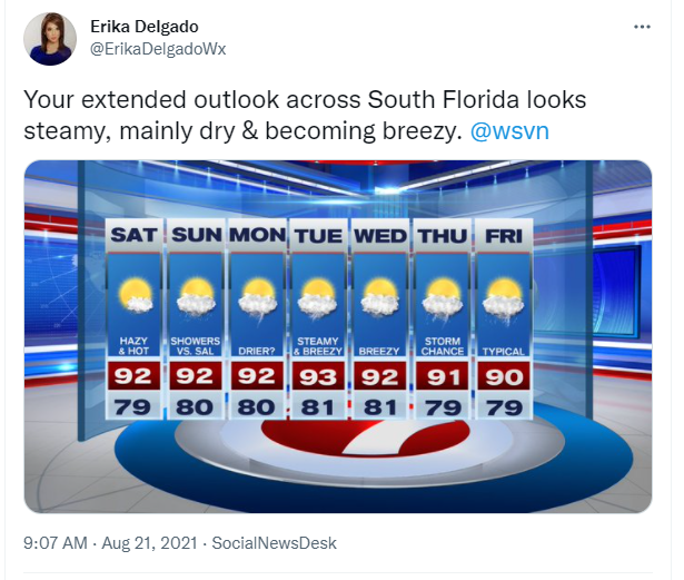
Today we can expect a similar weather pattern as we have been seeing in previous days. A mainly dry start to the day will lead to a steamy afternoon with temperatures in the mid to lower 90s. Once you factor in the humidity, our feels-like temperatures will reach well into the 100s once again. So if you are spending any significant time outdoors today, please be sure to keep hydrated! Rain chances will also remain very low today. One noticeable change today will be our skies turning a bit hazy through the second half of the day as the leading edge of Saharan dust begins to approach South Florida.
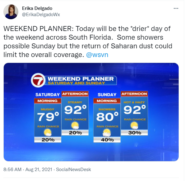
The latter part of the weekend promises the same steamy temperatures while Saharan dust continues to move into South Florida. Moisture at the surface will also begin to increase across South Florida so there will be a battle between the moisture and the drier Saharan dust across South Florida. Whichever one wins will determine how much rain, if any, we actually get on Sunday. So for now we’ll just go with a few showers possible through the latter part of your weekend with Saharan dust limits the overall coverage.
Looking ahead, a thicker layer of Saharan dust finally reaches South Florida and should limit any significant rainfall across our area through at least the first half of the work week. South Florida can expect hot and hazy conditions during this time with afternoon temperatures nearing the mid 90s across some areas and feels like temperatures well into the 100s. But as we head into the second half of the work week, Some of the dust begins to move off and fizzle over South Florida, which will allow for showers to slowly increase across our area. So after a mostly dry work week, expect rain chances to return to typical by the end of next week, along with a breezy onshore wind (a wind off the water).
Have a great weekend!
Erika Delgado
Meteorologist
WSVN Channel 7 News
Copyright 2024 Sunbeam Television Corp. All rights reserved. This material may not be published, broadcast, rewritten or redistributed.