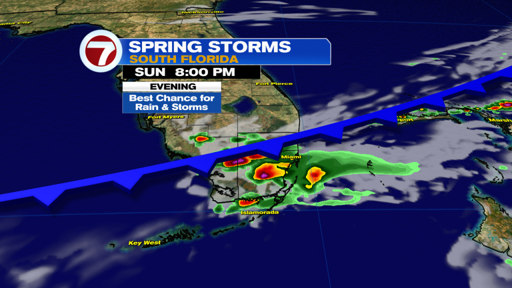
A weak front is tracking south down the Florida Peninsula and that will trigger a few showers and potentially strong thunderstorms by this evening on this first day of spring. This morning, besides a spotty shower near the coast, it is looking nice with mostly sunny skies and temperatures rising to about 80F by 10am.
Changes arrive once we get into the afternoon, however, as that front nears. A couple showers are expected to develop over South Florida around 2 or 3pm, then they will become a bit more widespread by the evening. Also by the evening, there could be a couple thunderstorms, especially between 5 and 9pm. There is even the risk for an isolated severe storm, packing strong winds and/or small hail. Considering the slow-movement of these storms and moderate moisture levels in the atmosphere, there is the marginal risk for flooding today into tonight from southern Broward County through the northern Florida Keys, according to the Weather Prediction Center.
Conditions will improve late tonight across most of the region as drier air begins to sweep in behind the front. A couple showers will remain possible across parts of the Keys, however.
This front will drop temperatures closer to average by Monday morning. Lows on Monday will be around 70F across the mainland and low to mid 70s in the Keys. There will be a good amount of sunshine, heating up the air to around 80F for a daytime high, which is also around average. The nice feature of Monday is the brief relief from the high humidity levels but that will be short-lived.
For the first half of this new week, it will be breezy at times with gusts up to 20-30 mph in spots thanks to a distant high pressure. There will also be a stalled front to our south over the Florida Straits, so there will be a 20% chance for rain from Monday through Wednesday. Our next notable chance for rain will then arrive Thursday into Friday from another front.

