Happy Thursday, South Florida!
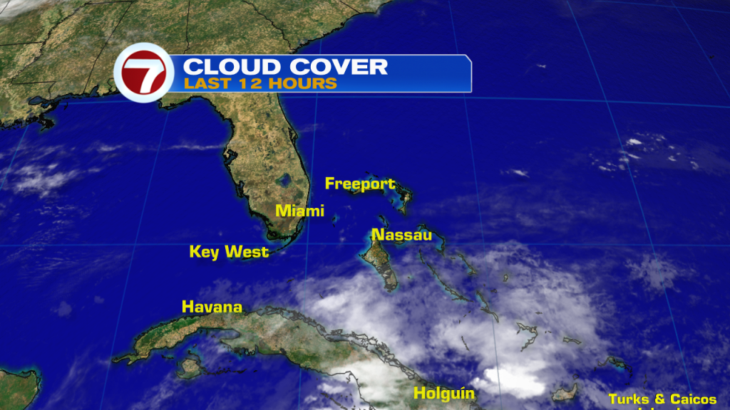
We are officially halfway through the work week, which means the weekend is right around the corner,…And this week so far we have seen a mixed bag of weather. The week started off stormy and has now transitioned to a steamy and mainly dry one. This morning was no different as we saw just a few isolated showers (near the Florida Keys), calm and quiet across Mainland areas with mild and muggy conditions for all.
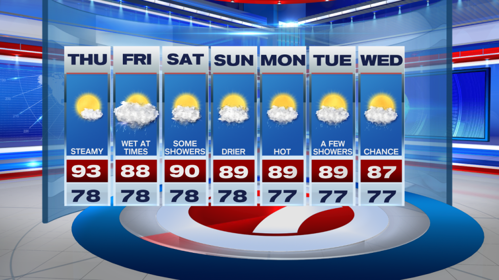
Today will be a lot like what we saw yesterday. While today will not be completely dry, rain chances will remain very spotty to isolated, with the best chances looking like inland and interior sections of South Florida. Our inland suburbs of Miami Dade and Broward County could see a few showers before all shower and thunderstorm activity begins to push out west. After starting off in the upper 70s and lower 80s this morning, our afternoon high temperatures will once again reach into the mid to lower 90s. This means that with the added humidity, our feels-like temperatures will be nearing 100°, especially across our inland locations.

Looking ahead, the end of the work week could begin to turn unsettled for South Florida. Tropical moisture from the Caribbean could increase across our area (if it holds together), which would increase our rain and thunderstorm chances as early as Friday. The beautiful blue skies we have been enjoying will also be a thing of the past as we can expect more clouds starting Friday. If the moisture actually holds together even longer, then the unsettled weather pattern could linger into the upcoming weekend. There is still lots of uncertainty with the weekend forecast so, for now, if you have any outdoor plans for the upcoming weekend, it might be best to bring them indoors,…or at least have a plan B. As of this writing, Friday looks to be the best chance for any rain around South Florida.
Have a wonderful afternoon!
Erika Delgado
Meteorologist
WSVN Channel 7 News
Copyright 2024 Sunbeam Television Corp. All rights reserved. This material may not be published, broadcast, rewritten or redistributed.