Happy Sunday, South Florida!
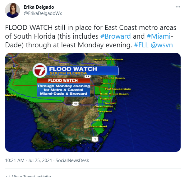
Hopefully everyone was able to enjoy the start of the weekend despite the fact that we saw downpours and strong thunderstorms across South Florida from time to time. There was some dry time during the afternoon so at least the day wasn’t a complete washout. This morning started off less active as far as thunderstorm activity than what we saw on Saturday morning but there were still a few showers across the Upper Keys they had already developed. The rest of South Florida looked rather quiet during the early morning hours but the Flood Watch for portions of South Florida remains in place due to the rain & storms expected through the start of the week.
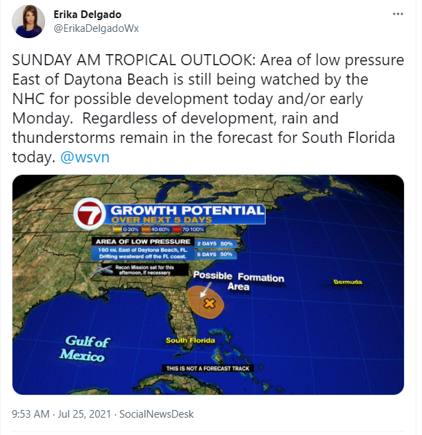
The National Hurricane Center is still monitoring an area of low pressure that has been meandering over the Atlantic just east of Daytona Beach. With this area of low pressure nearby, and with abundant tropical moisture over South Florida, our rain and thunderstorm chances will remain on the higher side. A tropical depression could still form in the next day or so. However, regardless of development, the forecast for South Florida will remain the same through the start of next week.
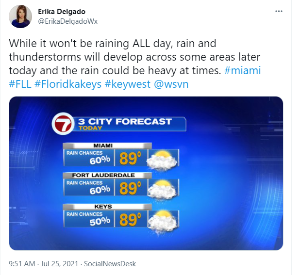
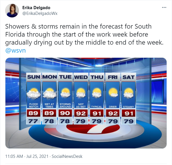
So what can we expect today? South Florida will see times of rain and during those times, the rain could be heavy. Will it rain ALL day? No. But there will be spots that get rain and thunderstorms throughout the day. Yesterday some South Florida spots received more than 4″ of rain so the Flood Watch that had been issued for coastal and metro areas of South Florida (Miami Dade, Broward and West Palm Beach) remains in place through at least Monday evening.
That takes us at least through the day on Monday. Tuesday will actually be quite transitional for South Florida. We will still see showers and thunderstorms in the forecast but a layer of Saharan dust finally reaches South Florida and that could lower our rain chances as we head through the middle to end of the workweek. Now that’s not to say we will see dry conditions but at least we will slowly transition to more typical rain chances. And we will finally see those typical rain chances by the end of the workweek. In the meantime, grab your rain gear and keep it with you through Monday because we will be needing it!
Keep dry and enjoy the rest of your weekend!
Erika Delgado
Meteorologist
WSVN Channel 7 News
Copyright 2024 Sunbeam Television Corp. All rights reserved. This material may not be published, broadcast, rewritten or redistributed.