Happy Sunday, South Florida!
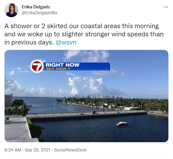
Hopefully everyone had a nice start to the weekend! Our Saturday started off quite nice with plenty of dry time to start and then afternoon thunderstorms rolled in as we have been seeing in previous days. Unfortunately some of the thunderstorms and some of the rain did linger into the evening but with the loss of the heating of the day, it all slowly began to taper off. This morning we woke up to shower and thunderstorm activity across our local waters but it was evident that there were already changes underway across our area.
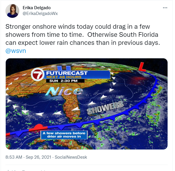
One of the noticeable changes today will be the building breeze across our area. And we already saw and felt that change earlier this morning. A front has been drifting south across South Florida since the start of the weekend, which is quite unusual for us given the time of year. But with the front still close by, and with an onshore flow out of the Northeast, a few showers may still be possible today, especially along our coastal locations. Then drier air will begin to move into South Florida later in the day. Temperatures will still remain warm in the mid to upper 80s across South Florida. And then the changes finally reach us as we head into next week.
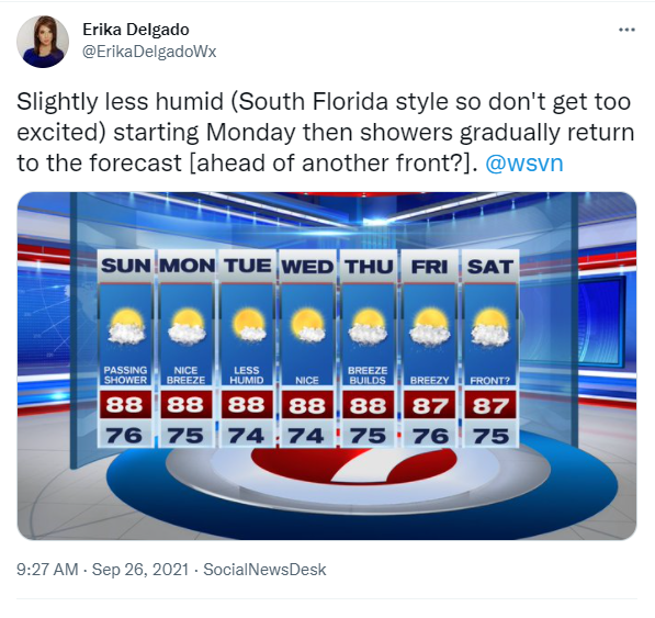
Speaking of next week, the front is forecast to have cleared all of South Florida by Monday bringing slightly lower humidity behind it. As the drier air begins to move in, South Florida will feel somewhat of a difference. The difference won’t be so much as far as our temperatures are concerned (although mid to upper 80s does sound better than mid to lower 90s) but the change will be more felt as far as humidity levels are concerned. To be quite honest, a front this time of year doesn’t usually clear South Florida so we should definitely feel lucky that we’re even getting some of this nice weather. And this nice weather looks to stick around through at least the first half of the work week before showers slowly return to the forecast by the end of the week. Ohh and spoiler alert: looks like ANOTHER front will try to swing through South Florida by the start of next weekend!
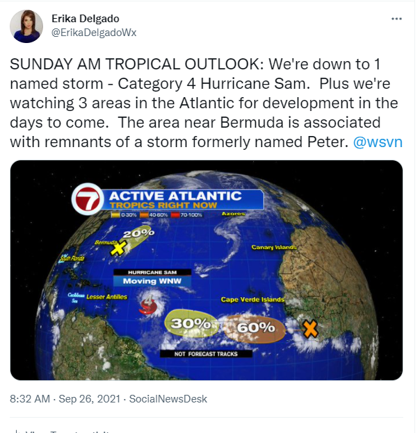
One quick check on the Tropics: an Active Atlantic continues as we round the corner into the end of September. Right now we have 1 named storm plus 3 other areas that the National Hurricane Center is watching for potential development in the next few days. The named storm is Hurricane Sam, which remains a powerful major hurricane. Luckily it is forecast to miss the islands and take a turn towards the north in the next few days. However, interests in Bermuda should continue to monitor the progress of Sam as the could have a major hurricane in their area by the end of the upcoming work week!
Have a great rest of your weekend!
Erika Delgado
Meteorologist
WSVN Channel 7 News
Copyright 2024 Sunbeam Television Corp. All rights reserved. This material may not be published, broadcast, rewritten or redistributed.