As a cold front moves across South Florida on Sunday, a dry north breeze and dip in degrees will follow into the start of the work week. This dry front will keep us mostly sunny with highs in the upper 70s to close out the weekend.
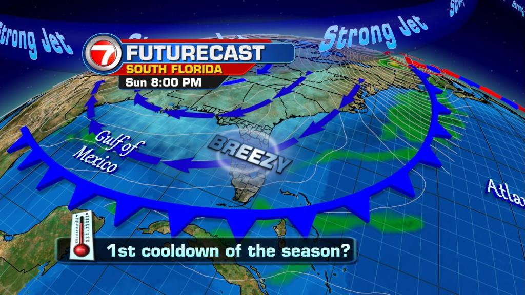
On the backside of this front, models suggest a slip in temps. This will result in the 50s making a comeback in South Florida on Sunday night/Monday morning. The metro & coastal cities will be in the upper 50s to low 60s with the inland temps dipping into the mid 50s.
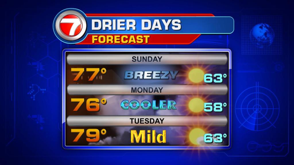
As high pressure builds in behind the front, a dry trend will stick around for the first half of the week. Ahead of another cold front, models are straying away from a total washout. With that being said, we cannot rule out spotty showers on Thanksgiving Day under partly sunny skies.
TROPICS
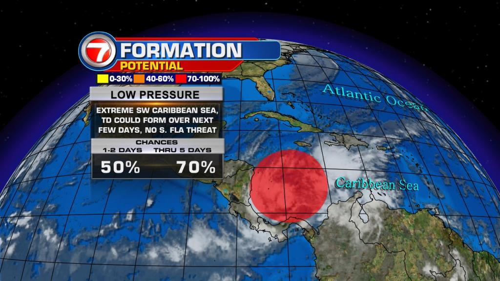
The National Hurricane Center is giving an area of low pressure in the southwestern Caribbean Sea a high chance for tropical development over the next 5 days. Additionally, per NHC, only a small increase in the organization of the low could result in the formation of a tropical depression within the next few days.
The development area is highlighted in red.
Copyright 2024 Sunbeam Television Corp. All rights reserved. This material may not be published, broadcast, rewritten or redistributed.