Happy Saturday, South Florida!
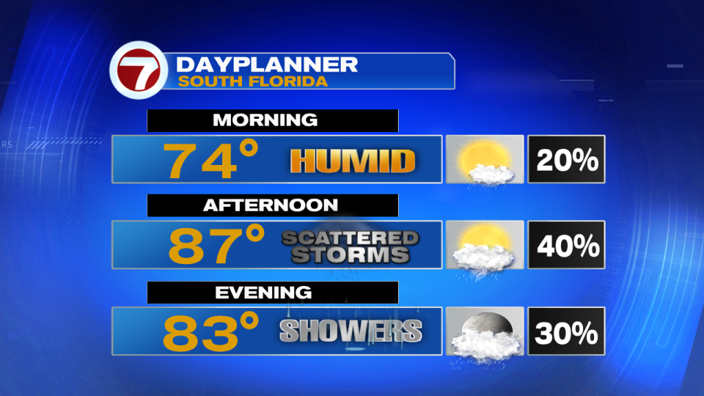
Hopefully everyone had a great work week! The middle of May is finally here and the start of the rainy season in South Florida begins on Sunday. But the last couple of days we have truly felt the transitional period as we have been seeing strong thunderstorms and plenty of shower activity across South Florida through the afternoons. And while our afternoons have been a bit more active as far as rain and thunderstorms, our mornings have been a little more typical of what we normally see during the dry season. However, this morning we saw a difference as far as rain. South Florida started off with scattered showers and a few isolated thunderstorms especially along our coastal locations. This is a sign that the pattern is changing.
An upper level low pressure system moved across North Florida within the last 24 hours or so. This helped trigger thunderstorms on Friday afternoon and will help trigger thunderstorms once again this afternoon. So we can once again expect scattered thunderstorms in the forecast today and we should be good to see them develop just after lunchtime. We will also notice temperatures a touch warmer than we were yesterday. Afternoon high temperatures will be reaching into the mid to upper 80s. And worth mentioning, King tides are back! This means our high tides are running higher than they normally would. This could result in some minor saltwater flooding along our coastal locations of Broward county, Miami Dade and the Upper Florida Keys.
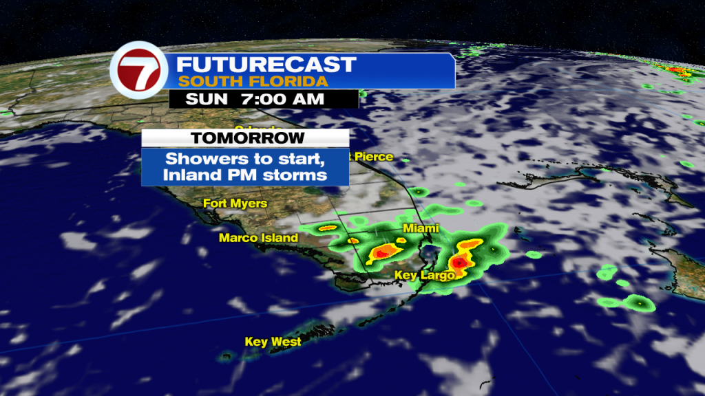
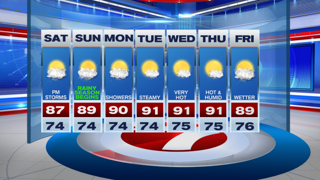
The latter part of the weekend promises some changes. Unlike today’s weather setup, South Florida can expect showers to start the day. A few afternoon thunderstorms will still be possible but the focal point for any storm activity will be across inland locations. So we will call Sunday afternoon’s storms to be ‘hit or miss’. Also another noticeable difference from today will be our afternoon high temperatures that will be a bit closer to 90° on Sunday. Many South Florida locations will reach into the upper 80s and some will actually reach the 90s.
Looking ahead, it only gets warmer from there. With winds beginning to veer out of the south and then out of the Southwest, this will have a direct impact on our afternoon high temperatures. So through the start of the work week (and pretty much the entire week), temperatures will be reaching into the 90s across many South Florida locations. And even though temperatures will be above average each day, no record temperatures are expected to be met. And different from this weekend, the upper level low will already be out of our area so rain and thunderstorm chances will remain at a minimum through much of the week. However, as we fast forward to the end of the work week, we can once again expect scattered showers and thunderstorms in the forecast.
Have a great weekend!
Erika Delgado
Meteorologist
WSVN Channel 7 News
Copyright 2024 Sunbeam Television Corp. All rights reserved. This material may not be published, broadcast, rewritten or redistributed.