Happy Sunday, South Florida!
What a beautiful start to the weekend in South Florida! Hopefully everyone was able to take advantage of outdoor plans despite the heat because it sure was beautiful and sunny outside. Conditions remained mainly dry and we saw those beautiful blue skies we like to see on summer days. But unfortunately all good things do come to an end and it looks like this short-lived weather pattern will do so as well. Earlier this morning we already saw big differences in the weather pattern with plenty of shower and thunderstorm activity over the Atlantic waters.
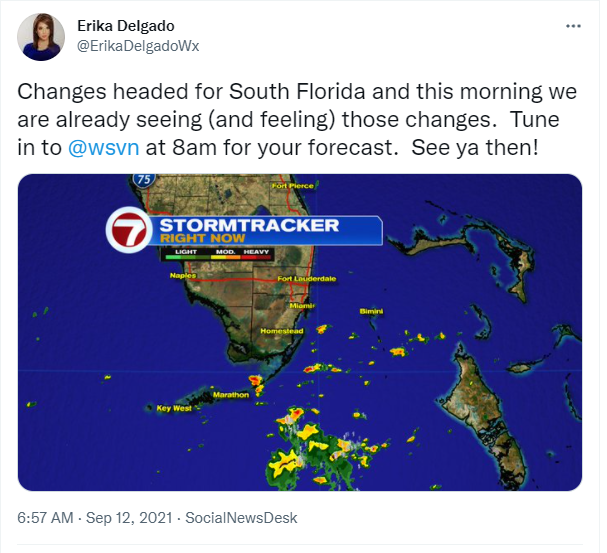
As mentioned above, today brings some changes to the forecast. For one, there is a tropical wave over the Bahamas that should make its way towards South Florida tonight into early Monday. Secondly, the onshore flow (our easterly winds) that returned to the forecast on Saturday will pick up a bit, turning breezy to gusty at times today. This will help tap into moisture from the Atlantic and Bahamas and will bring a few scattered showers and thunderstorms our way from time to time….especially by tonight. So unfortunately the drier weather we enjoyed through the first half of the weekend will come to an end as we will have to bump up our rain chances starting today.
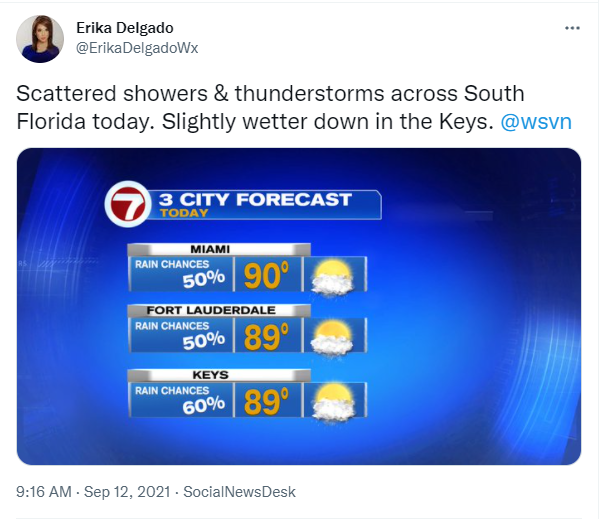
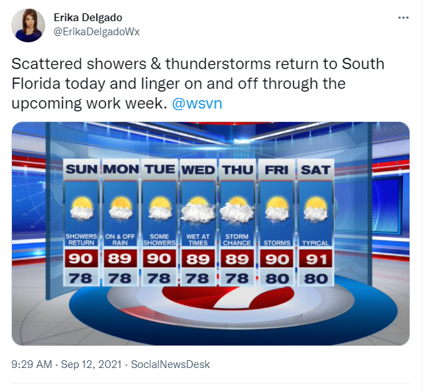
Looking ahead, South Florida looks to remain under a wetter weather pattern at times throughout the week. A series of disturbances will try to make their way across our area, bringing moisture along with it. So through much of the work week, South Florida may see showers and thunderstorms continuing on and off. Of course we all know how fickle these disturbances could be so all of this will be highly dependent on whether or not they actually hold together and make it to South Florida. Right now, no day is looking like a complete washout but be sure to have an umbrella with you in case you encounter a shower at some point!
Have a great weekend!
Have a great rest of your weekend!
Erika Delgado
Meteorologist
WSVN Channel 7 News
Copyright 2024 Sunbeam Television Corp. All rights reserved. This material may not be published, broadcast, rewritten or redistributed.