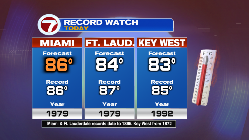
It’s been a warm and humid past couple days and the summer-like weather does continue this weekend thanks to an area of high pressure in the upper levels of the atmosphere centered over South Florida. This upper high will allow for temperatures to near to reach record highs today and tomorrow. In Miami, today’s forecast high of 86F would tie the current record of 86F set back in 1979. Fort Lauderdale and Key West will likely remain short of reaching today’s records.
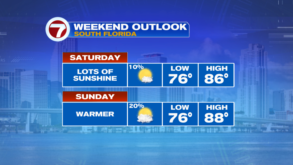
This heat and humidity, which will make it feel like the 90s, will be paired with lots of sunshine and a light breeze coming off the ocean out of the east. That onshore flow will provide a moderate risk for rip currents at the east coast beaches. There could be a spotty shower but most of the area will enjoy the dry weather this Saturday.

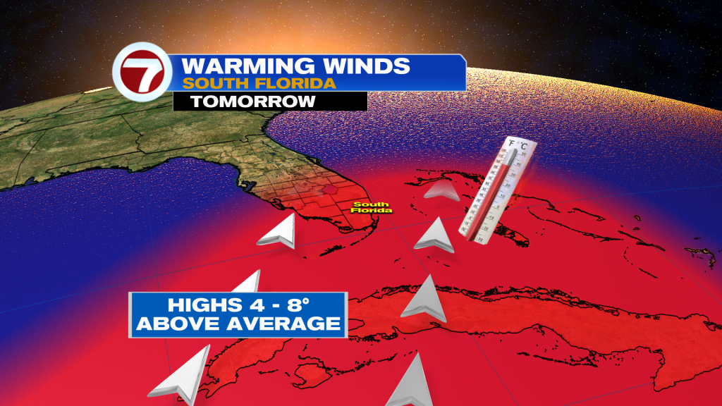
Sunday will unfortunately be hotter with highs expected to be a degree or two warmer in the mid to upper 80s as that wind shifts out of the south-southwest, providing that hot land breeze across the mainland. There will be a few more clouds around Sunday with a spotty shower, but it will be another hot and bright day.
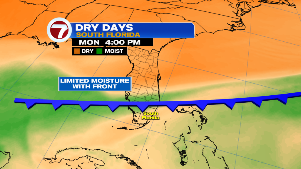
A weak cold front will reach South Florida by Monday, but only minor cooling is expected behind this front midweek. There also won’t be much moisture associated with this front either, so besides a spotty shower most of the area should remain dry.