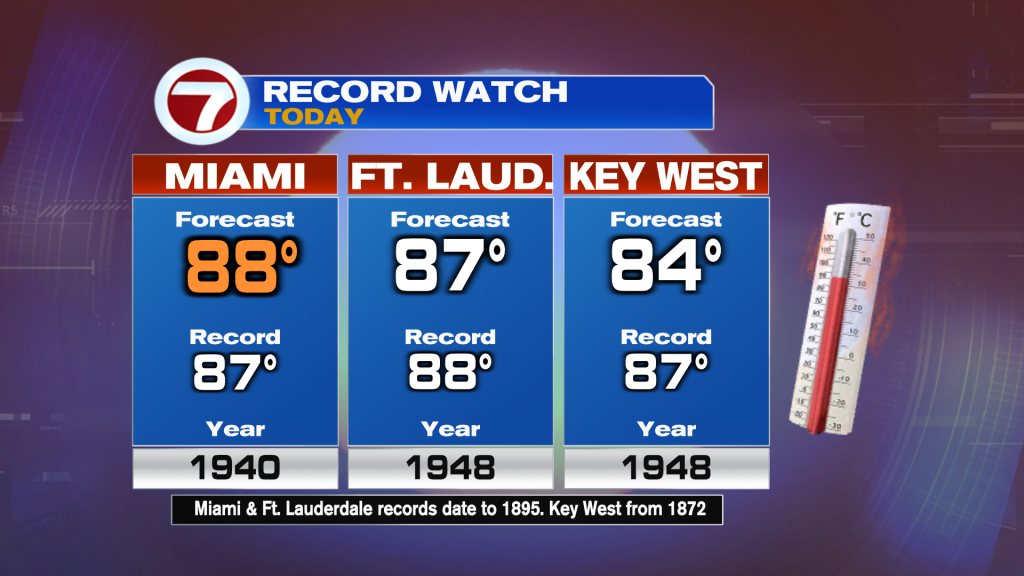
Another nice but hot and humid day is in store to finish off the weekend this Sunday. After breaking the record high of 86F set back in 1979 on Saturday with a actual high of 87F in Miami, we could break today’s record too. If the high reaches the forecast of 88F, that would break the current record of 87F set in 1940. Fort Lauderdale and Key West will also be hot with feels-like temperatures in the 90s but will likely be a couple degrees or so away from reaching the record this date.
The heat is all due in part to an upper level area of high pressure centered near South Florida that produces and traps heat, and that feature along with a southwest flow will be responsible for above average temperatures across much of the southern and eastern US this Sunday.
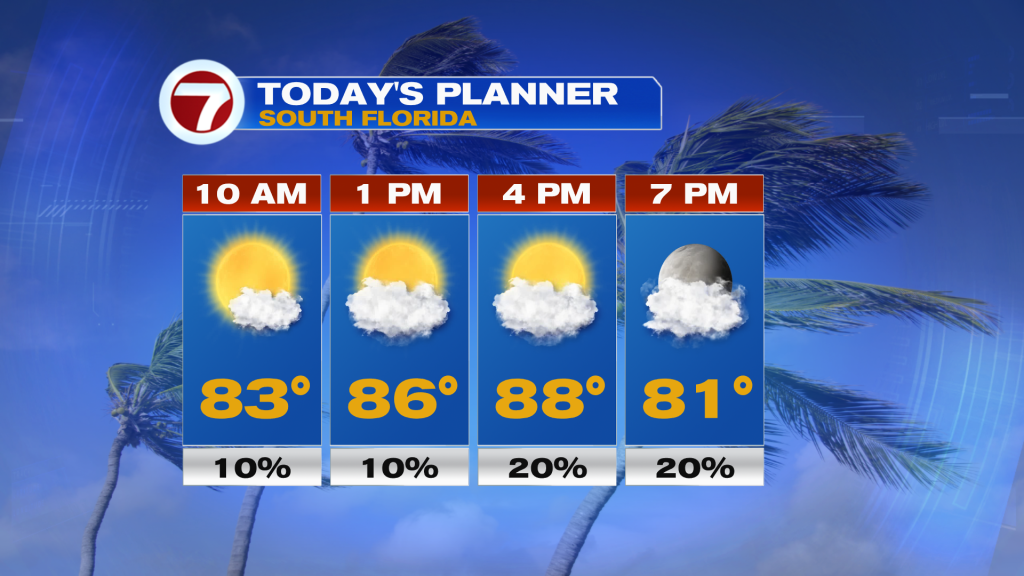
In addition to the heat, it will be another mostly dry day with rain chances at normal at a 10-20 percent chance. Only a couple, afternoon spotty showers will be possible. The day will feature mostly sunny to partly cloudy skies with temperatures warming into the 80s by late morning. The wind will be light out of the south-southwest from 5-10 mph. The rip current risk at our east coast beaches will remain at a moderate category.
Tonight will not be as warm, with wake-up temperatures Monday in the low to mid 70s, which is still about 5F above average. That will be paired with a few clouds and the potential for fog around the sunrise hours, especially across inland sections of South Florida.
Monday will be another warm and humid day with generally sunny skies and highs once again above average in the mid to upper 80s. A weak front will arrive into South Florida on Monday but will not completely clear through the area. This will cause a wind shift from the south-southwest today to the northeast Monday into Tuesday, however. This will allow for about a 3F temperature drop by Tuesday, but temperatures will still be a few degrees above normal.
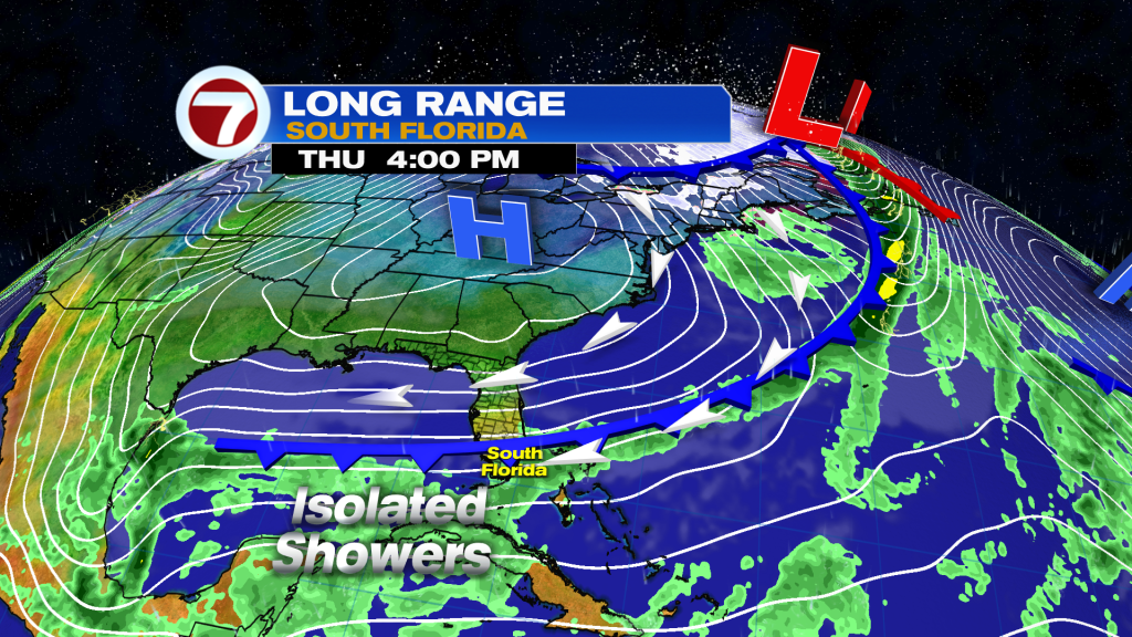
The upcoming week will remain generally nice and quiet. A second front does enter the picture around the Thursday period, too, but this will not be a strong, cooling front either. Temperatures could drop a couple more degrees late week behind it, and isolated showers will be possible during this time period, especially on Wednesday ahead of the front’s arrival. The model guidance does also suggest a drop in humidity with this front as well, but details on the exact effects of this front are to early to be completely determined.