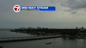
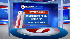
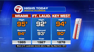
It’s the middle of May but we’re feeling steamy air that’s similar to late summer! On Tuesday, even with plenty of high clouds, temperatures soared into the middle 90’s. Officially in Miami, a 95-degree high was the hottest temperature since August, in 2017!
Miami and Key West made it into the record books with new highs for the date.
We’re also in an unsettled weather pattern. On Wednesday, storms are likely, arriving in rounds. There are concerns for lightning and heavy rainfall. If showers stream over the same area, we could also be facing localized street flooding issues. Regardless, drive with extra caution and be aware of fast-changing conditions.

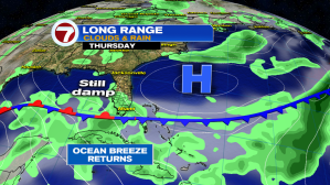
The weather map on Thursday shows a weakening front stretched across the Florida Keys. Rain will remain in the forecast with heavy downpours possible.
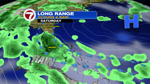
Glancing at the long range forecast, the weekend is also looking potentially wet. At this point, Saturday appears to be the wetter of the two weekend days. Hopefully on Sunday, a stronger breeze will allow things to dry out (at least slightly).