A big storm will provide a huge one-two punch from Texas through the Carolinas and even South Florida through early next week.

The Jet Stream is pushing a mass of cold air south. Where it runs into warm air out of the Gulf, the result will be heavy rain with possible severe weather across Texas and the Gulf States. It will make two other stops as it aims to move into the Atlantic Waters.
First Stop
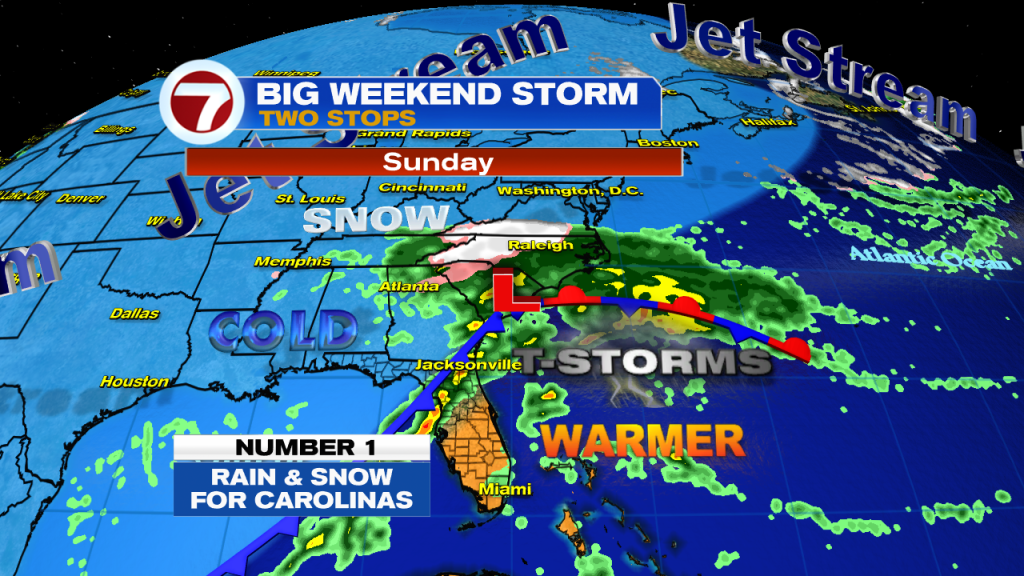
The cold air will reach the Carolinas by the second half of the weekend. Plenty of instability there will cause heavy rain, much of it turning to snow over North Carolina. Some cities could get up to a foot of snow.
Florida will have the leading edge of the front entering the area between Tampa and Jacksonville. Stormy conditions expected there. Our temps could be in the mid 80s, on Sunday. The warmest day of the weekend.
Second Stop

The front will then slide into the Eastern Atlantic with the tail end making the a second stop across South Florida. We may see a few downpours lingering into Monday morning with the colder air filtering in at night.
Rain Chances
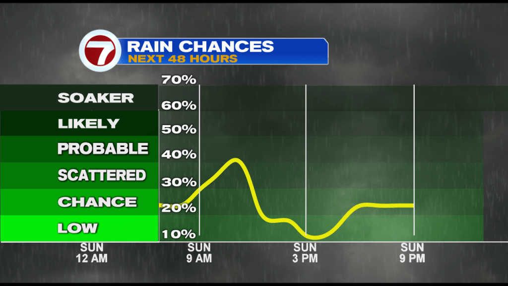
Our in-house model suggests the better rain chances will be around Sunday morning to Sunday afternoon. This may change if the front speeds up or slows down.
Forecast Temps
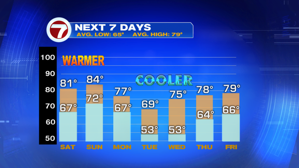
The weekend is looking warm but once the front arrives, the cold air will settle in for Tuesday and Wednesday mornings. We may even see a few of the western suburbs dip into the upper 40s.
We’ll keep you posted.