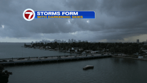
Heavy rain and storms made a dramatic comeback, from Friday afternoon through the start of the evening. Here’s a look at the dark sky over the city just before a drenching storm arrived west and south of downtown Miami.
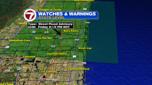
By far, the heaviest rain tallies (from Friday) were over the Broward Everglades. For the county “as a whole” we averaged around one-half an inch. It’s worth noting that extreme northeastern Broward County was under a Street Flood Advisory into Friday evening. The alert mainly spanned north into Palm Beach County where storms were heaviest.

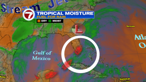
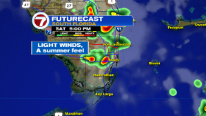
As deep moisture continues to get drawn northward (into our south Florida region) we’ll have the necessary “fuel” for developing storms over the weekend.
The most likely time to encounter a thunderstorm will be during the late afternoon hours and possibly into the early evening, too. Forecast models show this scenario panning out late Saturday, for example.
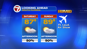
Here’s the weekend forecast, which will go down as both hot and humid. If you’re heading to the Ft. Lauderdale Air Show, be aware that storms could form (in scattered fashion) later in the day.