Happy Thursday, South Florida!
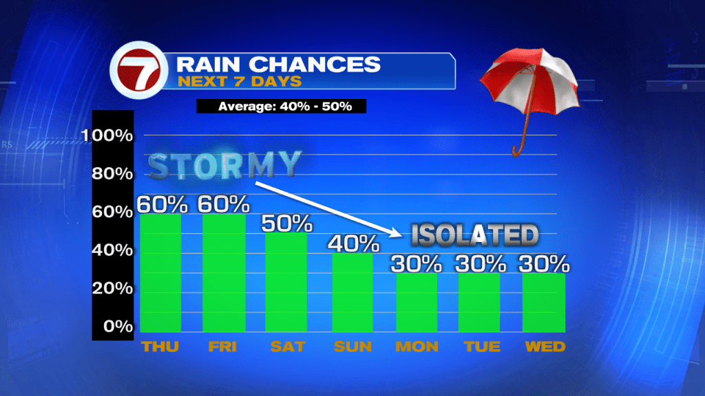
Hopefully everyone has had a nice week so far. The weekend is almost here and the weather pattern has not been in our favor this week. After flooding rain from Potential Storm #1 (then turned into Tropical Storm Alex), South Florida has continued to see flooding rains across our area on and off throughout the week. Many neighborhoods continue to be flooded as we continue to see rounds of rain and thunderstorms each day. And while Wednesday evening proved to be another wet one for us, early this morning started off rather quiet under mild and muggy conditions.

Today South Florida can expect some dry time through the morning and then showers and thunderstorms will once again move into our area this afternoon. The deep tropical moisture that has been over South Florida through the last couple of days is beginning to move out of our area. But with still enough moisture in place and with a Southwest steering flow (winds that steer thunderstorms), showers and storms remain in the forecast once again today. Afternoon high temperatures will be reaching into the upper 80s and some spots may actually hit 90° if the rain holds off until a bit later.

Looking ahead, the weather pattern remains unsettled. Even though South Florida has not been seeing rain all day long from morning to night, the rain that we have been seeing during the afternoons (and the rain and storm activity we are expecting to see through the next few afternoons) has been enough to trigger more flooding across South Florida. Showers and storms will still be in the forecast through the start of the weekend but some of our in-house models are suggesting that a thick layer of Saharan Dust may make it to South Florida. If it holds together, then the dust may actually limit our rain potential [finally!] early next week.
Remember to keep the rain gear close today!
Erika Delgado
Meteorologist
WSVN Channel 7 News
Copyright 2024 Sunbeam Television Corp. All rights reserved. This material may not be published, broadcast, rewritten or redistributed.