A soggy setup will remain intact across South Florida as deep tropical moisture continues to stream in from the Caribbean Sea. Nearby disturbances will keep steering winds out of the south as scattered to numerous showers and storms stay in the forecast into the weekend.

The main storm hazard will remain street flooding due to the ground already being saturated from relentless rain.
As these disturbances fade out, high pressure will start to build back over South Florida from the Atlantic. This will trigger drier air moving in. We could still see showers and a few storms on Sunday and Monday, but the coverage will be less than recent days.
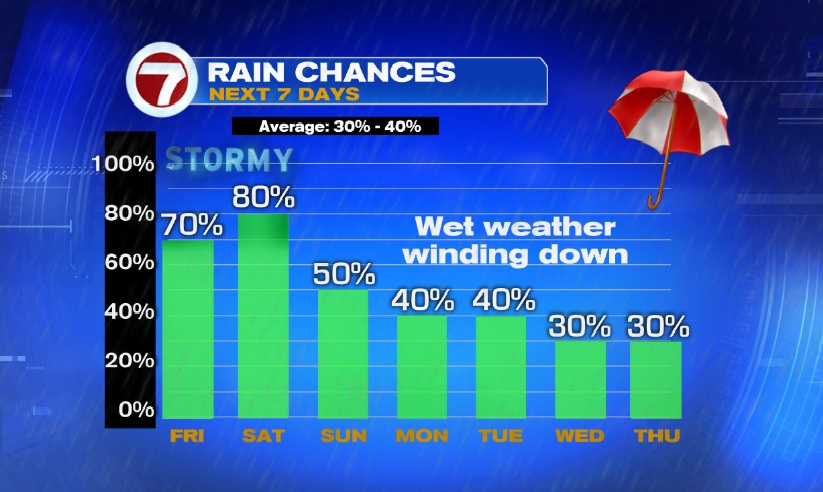
Expect high pressure to setup a more summer-like pattern of isolated coastal and metro morning showers and inland afternoon/evening thunderstorms by the middle of the week.
Copyright 2024 Sunbeam Television Corp. All rights reserved. This material may not be published, broadcast, rewritten or redistributed.