

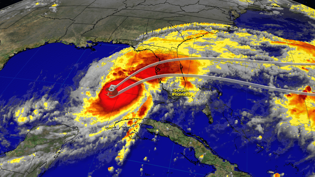
All eyes remain on extremely strong, Major Hurricane Milton over the southeastern Gulf of Mexico as it’s set to make landfall on the west-central coast of Florida Wednesday night.
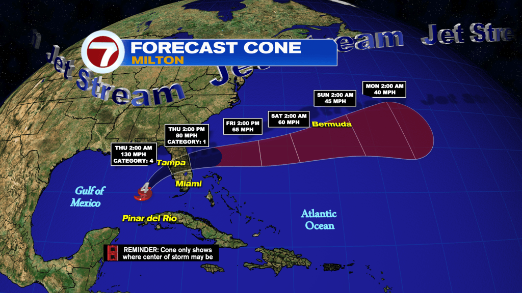
Since late Tuesday through early Wednesday morning, Milton has maintained Category 5 strength but is forecast to weaken somewhat before making landfall. Landfall is most likely to happen between the Port Charlotte and the Tampa Bay areas between midnight and 4AM Wednesday night as a Category 4 hurricane.

Very heavy rainfall, destructive winds where the center of the storm tracks, tornadoes and life-threatening storm surge are all forecast for parts of Florida.
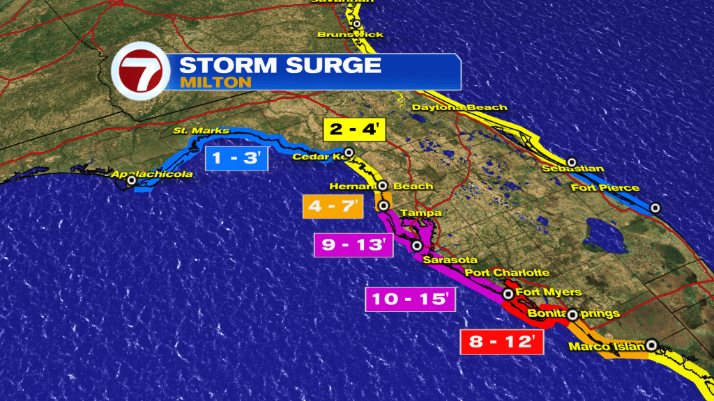
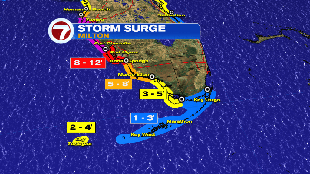
The highest surge values are forecast near and south of Tampa Bay on the west coast.
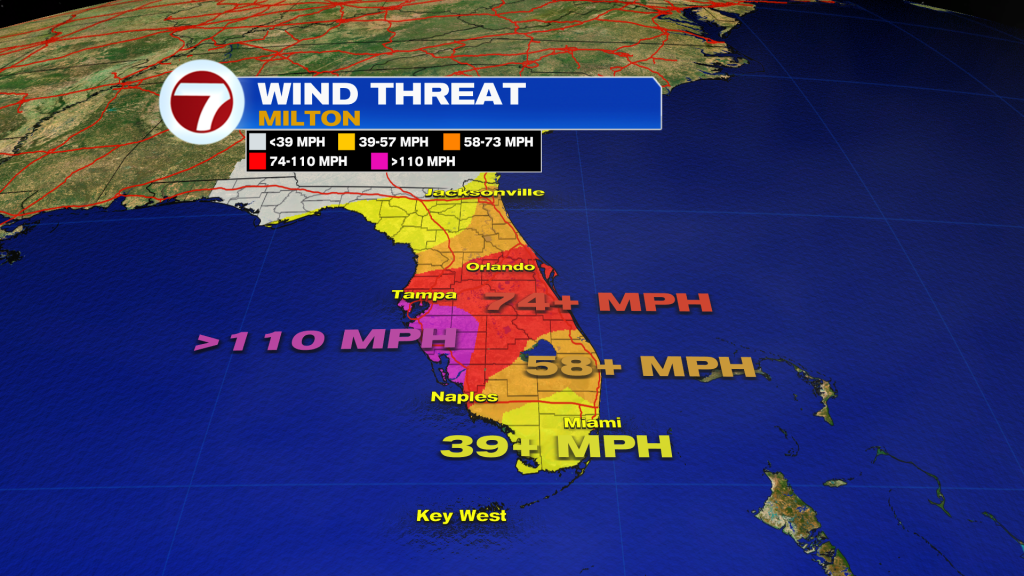
The strongest of the winds will occur near and just south of where Milton makes landfall in Florida.
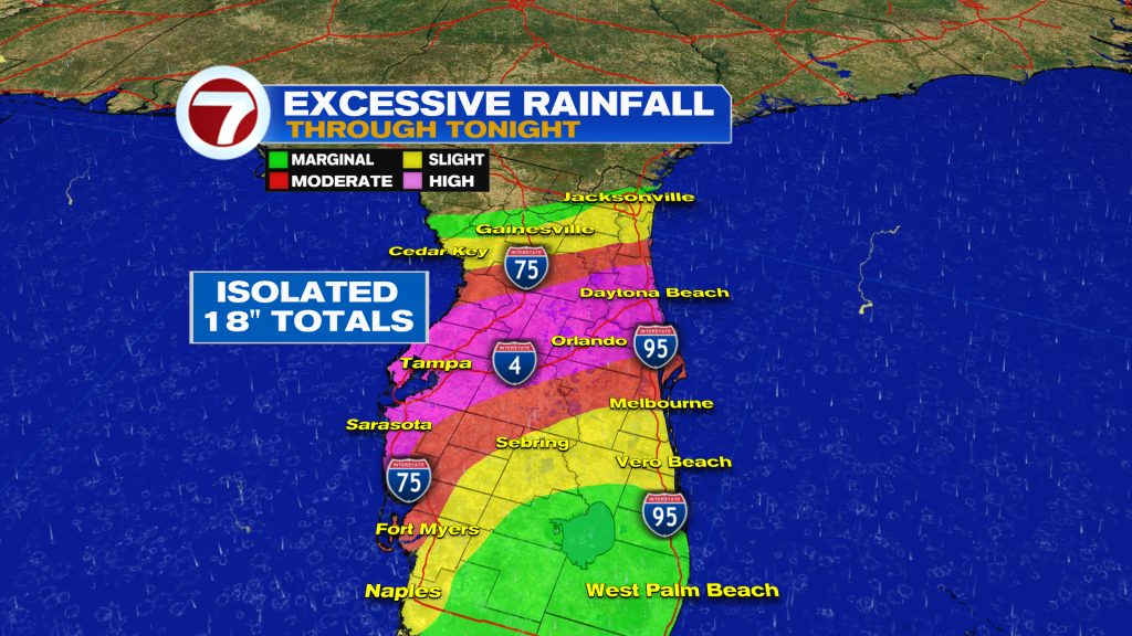
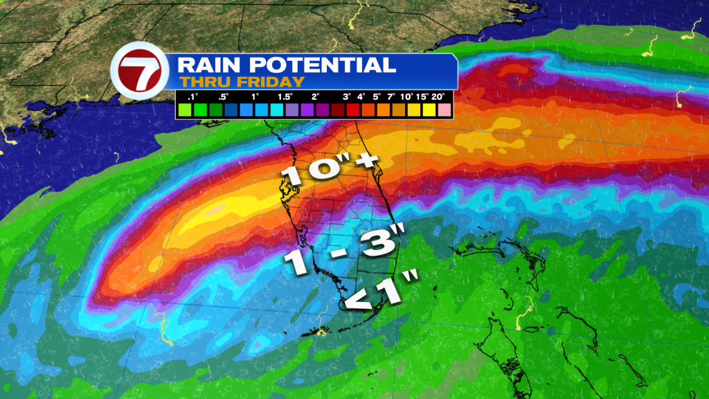
There is a high risk for excessive rainfall today into tonight across central Florida where flooding is likely to occur. Some locations could receive more than a foot of rainfall.
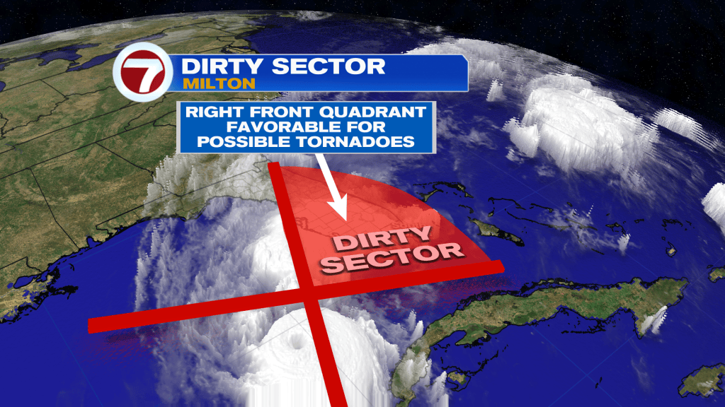
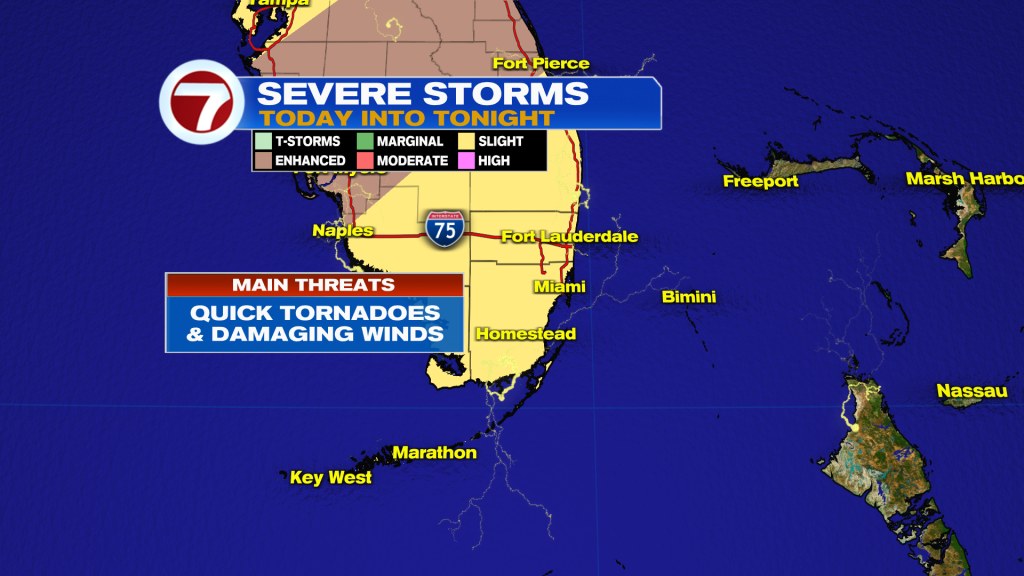
Lastly, quick-moving, brief tornadoes will be a concern across much of the Florida Peninsula, which is a common feature of landfalling storms. These tornadoes will be most likely in the right-front quadrant of Milton, which is known as the dirty sector.
South Florida impacts
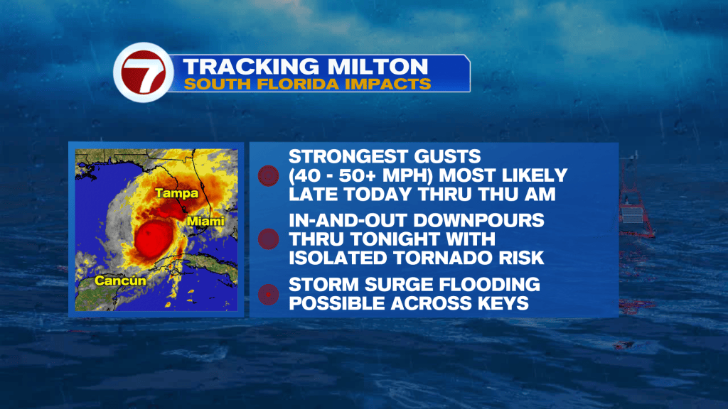
While South Florida will see impacts from Hurricane Milton, it won’t be as significant as other parts of the state.
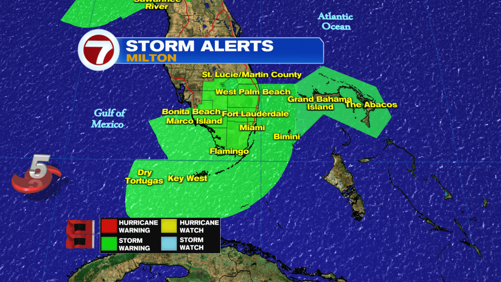
A Tropical Storm Warning is in effect for Miami-Dade, Broward and Monroe Counties for tropical-storm-force wind gusts (39+ mph) expected. The highest winds are forecast to occur late Wednesday through Thursday morning. Isolated power outages could occur as a result.
As previously mentioned, isolated tornadoes will be possible across the area too, especially during the day today.
A Flood Watch was previously in effect but has been cancelled given less than an inch of additional rainfall now forecast. Still, in-and-out downpours are likely to occur today into tonight, which will pack heavy rain along with strong winds.
The last concern for our area is storm surge across the Florida Keys where up to 1-3 feet of water inundation is forecast, with the highest impact during times of high tide.
Going forward, we’ll continue to see more clouds than sunshine for the rest of this week with showers becoming more isolated. It will still be windy Thursday and then breezy on Friday as humidity levels drop slightly.
Unfortunately, it you’re hoping for super dry weather, more scattered showers return to the forecast early next week.