A perfect weekend of weather is in store for South Florida on this first full weekend of 2023. Following the passage of a cold front early Friday morning, plenty of dry air has been left in its wake, providing lots of sunshine and a return to winter-like temperatures.
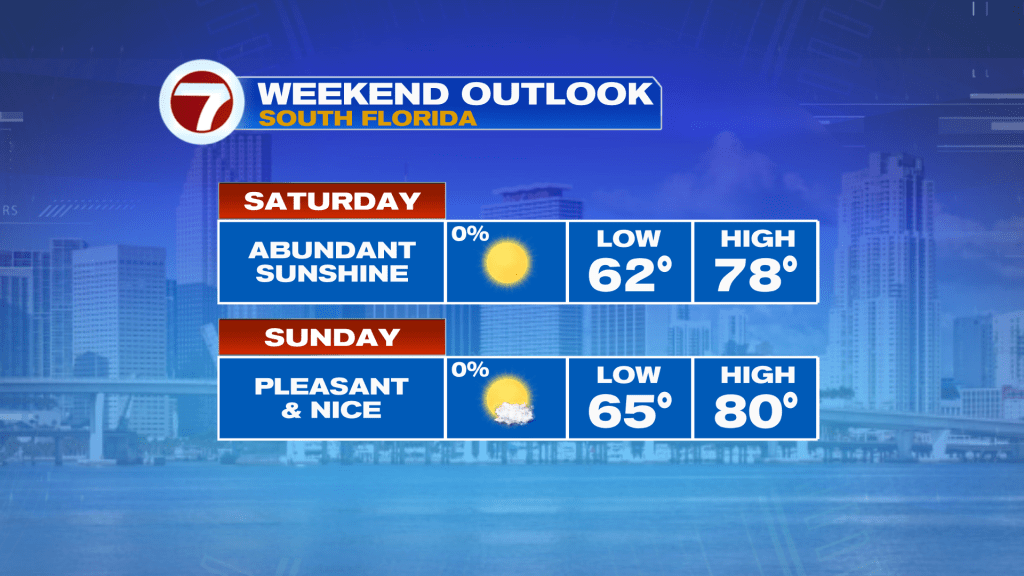
This Saturday, expect abundant sunshine and low humidity along with temperatures that are beginning in the 50s and 60s and then peaking into the mid to upper 70s in the afternoon. With temperatures in this range, it will be very typical for this time of the year but unfortunately it won’t last for much longer.
Temperatures tonight will return to above average levels with lows across much of the metro in the mid 60s and inland areas mainly in the low 60s thanks to a wind shifting more out of the east.
That easterly wind will also cause highs on Sunday to be 2-3F warmer than on Saturday into the upper 70s to around 80F. At least humidity will remain low and it will be another beautiful, bright and mostly sunny day.
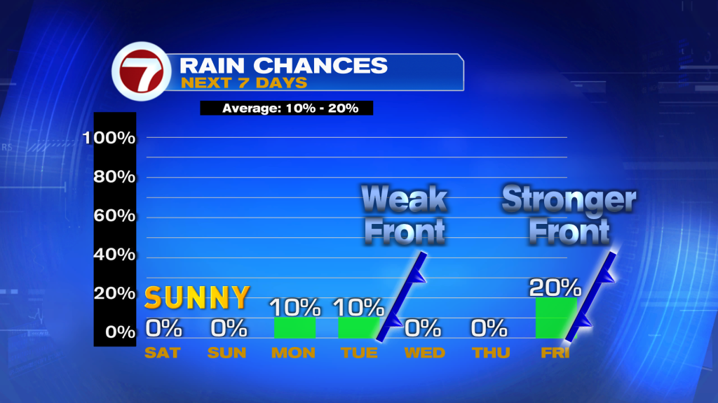
During the upcoming week, we will be tracking a series of cold fronts. The first two will be weak, which will near or through South Florida on Monday and then again on Wednesday. Given the lack of moisture, rain chances will be low at a 10% chance despite these fronts during the Monday through Wednesday time period.
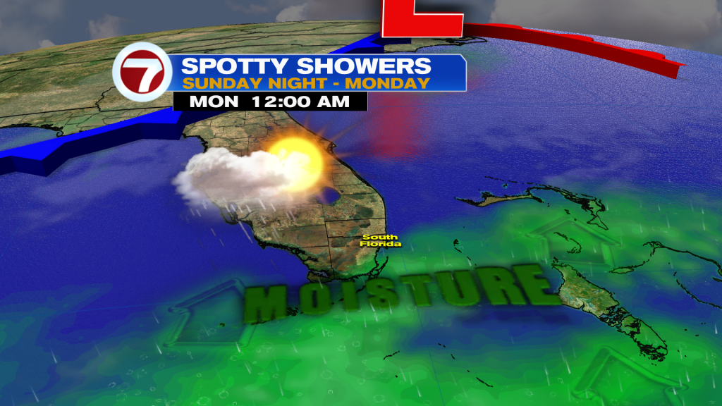
Otherwise, this time period will be characterized by a partly cloudy skies plus warmer temperatures ranging from the low to mid 80s early week to the upper 70s to low 80s by Wednesday behind the second front.
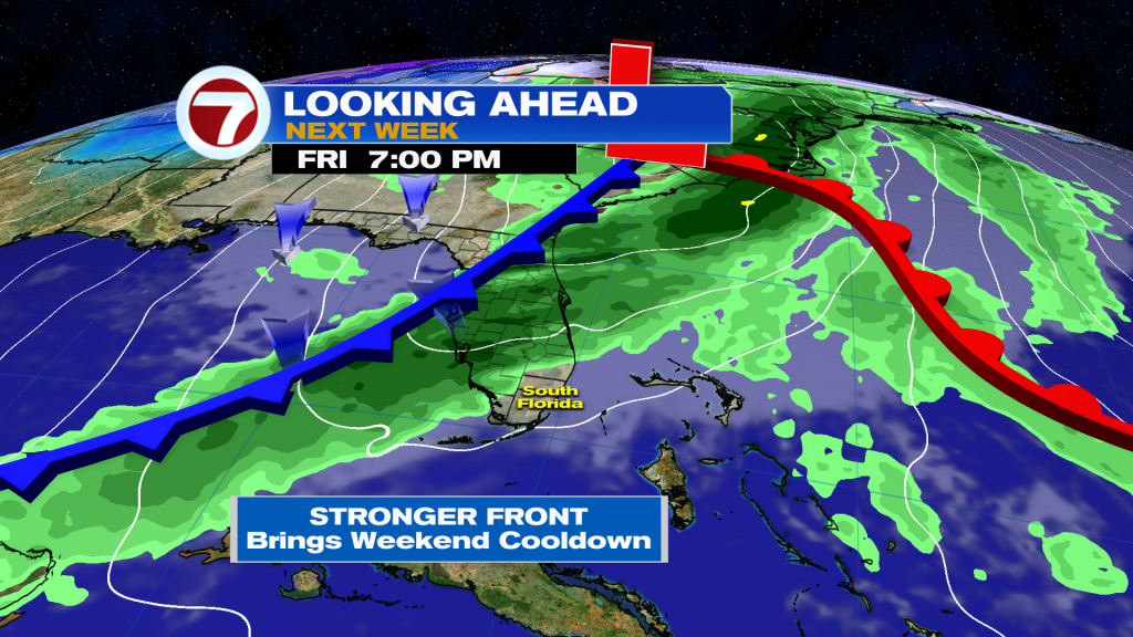
High pressure builds in late-week with temperatures slightly above average with mostly sunny skies. It’s not until around the Friday night time period that a potentially more potent cold front could arrive. As of now, a few showers will be possible, then a drop in temperatures for next weekend but the timing and outcomes of this potential front remain uncertain at this time given how far out in time it is.