A cool and dry change is in our South Florida air. Just take a look at the dry air (pictured below) swarming the Sunshine State. On the backside of a cold front cutting across Cuba, high pressure will continue to build in over the next few days.

On Wednesday morning, temps slipped into the low to mid 60s. Much of the same is expected for Thursday morning with another dose of sunny skies as highs peak near 80°.

Another cold front will make a beeline for South Florida by the weekend. But, this front will be rather dry. Models suggest isolated showers on Saturday and Sunday.
Behind the cold front, the humidity will drop again as temps slip into the upper 50s (western suburbs) and low 60s (coast and metro) by Sunday night/Monday morning.
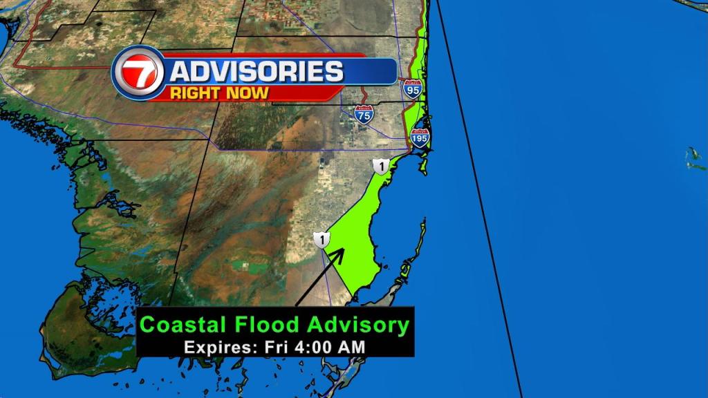
Additionally, coastal flooding will remain a concern with an extra pull on our high tides in wake of the Supermoon earlier this week. Minor flooding will remain an issue along the Atlantic waters and intercoastal communities from the Upper Keys to Palm Beach County through early Friday morning.
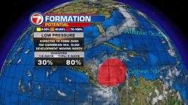
TROPICS
Clouds and showers associated with an area of low pressure over the southwestern Caribbean Sea remains disorganized. Models suggest possible slow development over the next 5 days.
The National Hurricane Center is giving this feature high chances for tropical development over the next 5 days. It could become a late season tropical depression no later than this weekend.
Copyright 2024 Sunbeam Television Corp. All rights reserved. This material may not be published, broadcast, rewritten or redistributed.