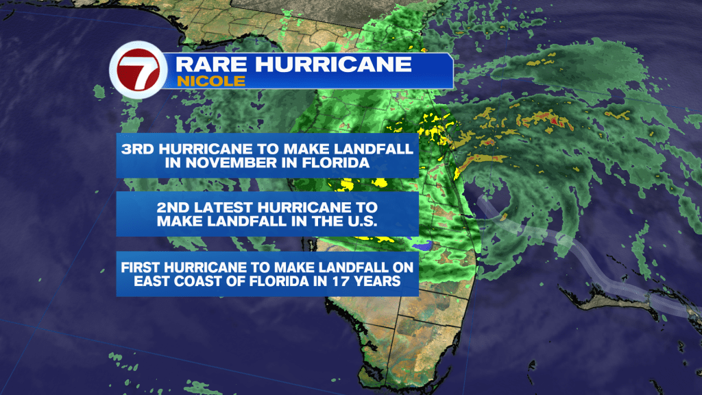
Nicole made landfall as a Category 1 hurricane with winds estimated at 75mph at North Hutchinson Island South of Vero Beach at 3am Thursday. This makes it a rare November hurricane. It is the third hurricane to make landfall in November in Florida, the second latest hurricane to make landfall in the U.S., and the first hurricane to make landfall on the East coast of Florida in 17 years (since 2005).
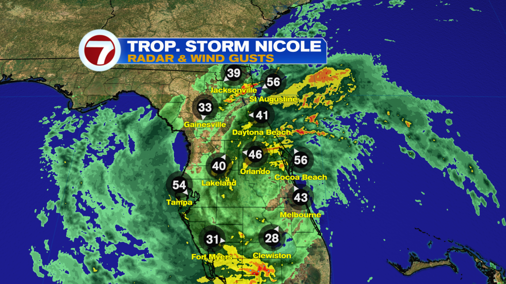
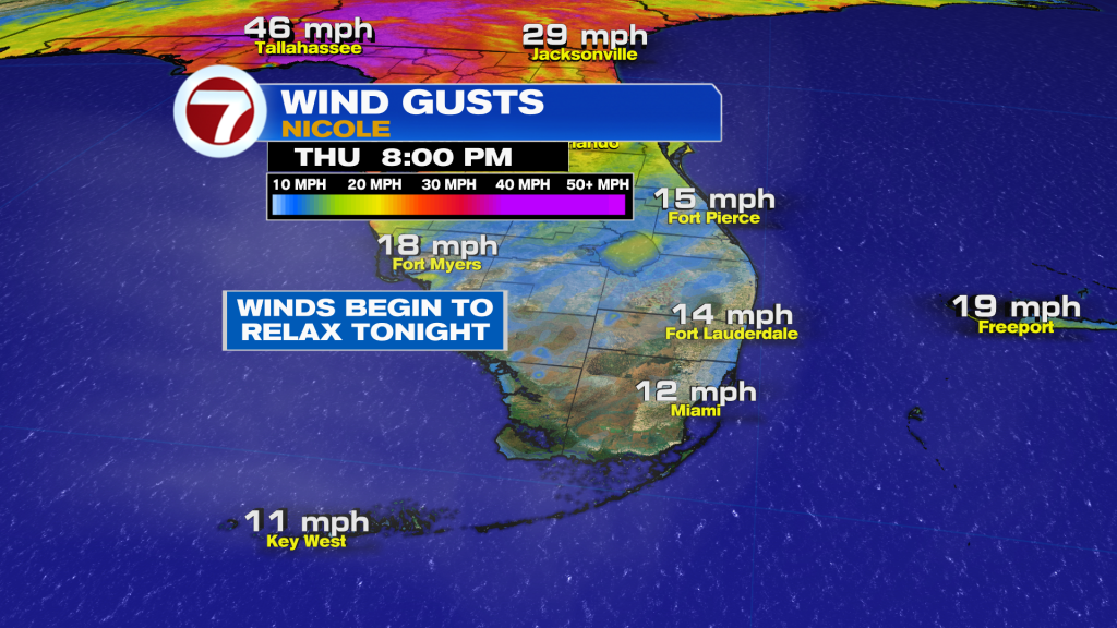
Now that Nicole has made landfall it is weakening and down to Tropical Storm strength. It is still producing strong gusty winds up to Tropical Storm-force with the center moving through Central Florida and you can clearly see where it is located by the direction of the winds down below.
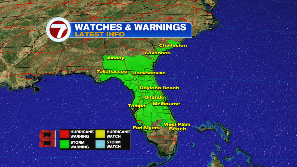
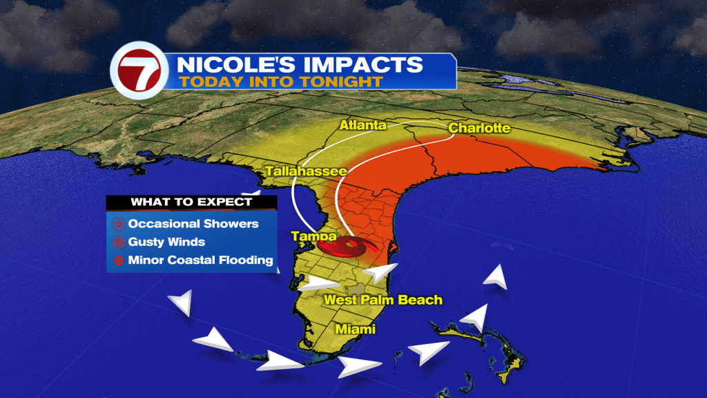
The Tropical Storm advisories for South Florida have been lifted since Nicole has moved North of our area. However, a good chunk of Florida remains under a Tropical Storm Warning. It is also includes portions of Georgia and South Carolina.
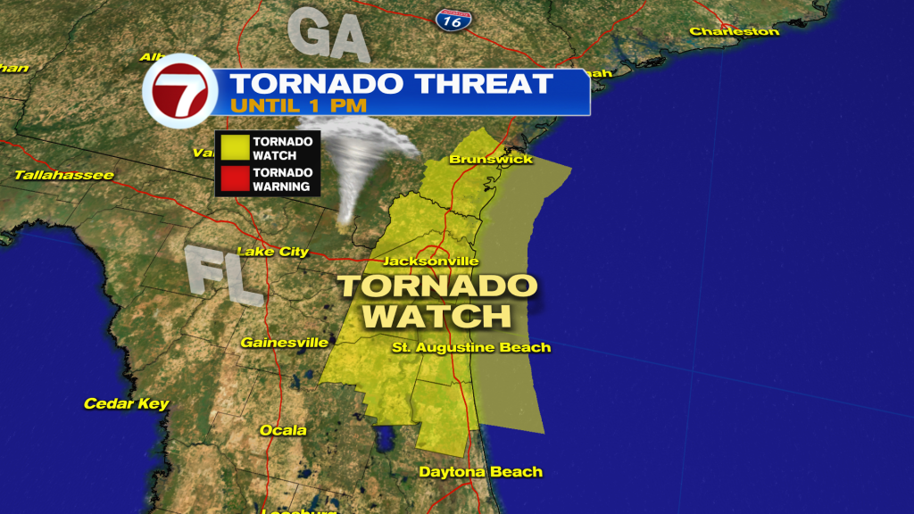
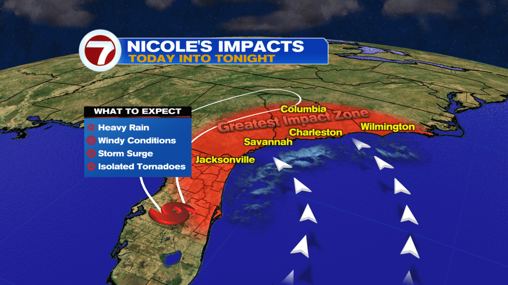
A Tornado Watch was issued for a portion of Northeast Florida since some of the outer bands could spin up isolated tornadoes.
Rain, wind and surge will be the main hazards for Central-North Florida through the coastline of the Carolinas today into tonight.
As Nicole lifts North and well away from South Florida, we will see the occasional showers, gusty winds and minor coastal flooding during times of high tide.
Heading into tonight winds go front gusty to breezy, so we should start to see improvements around our local waters.
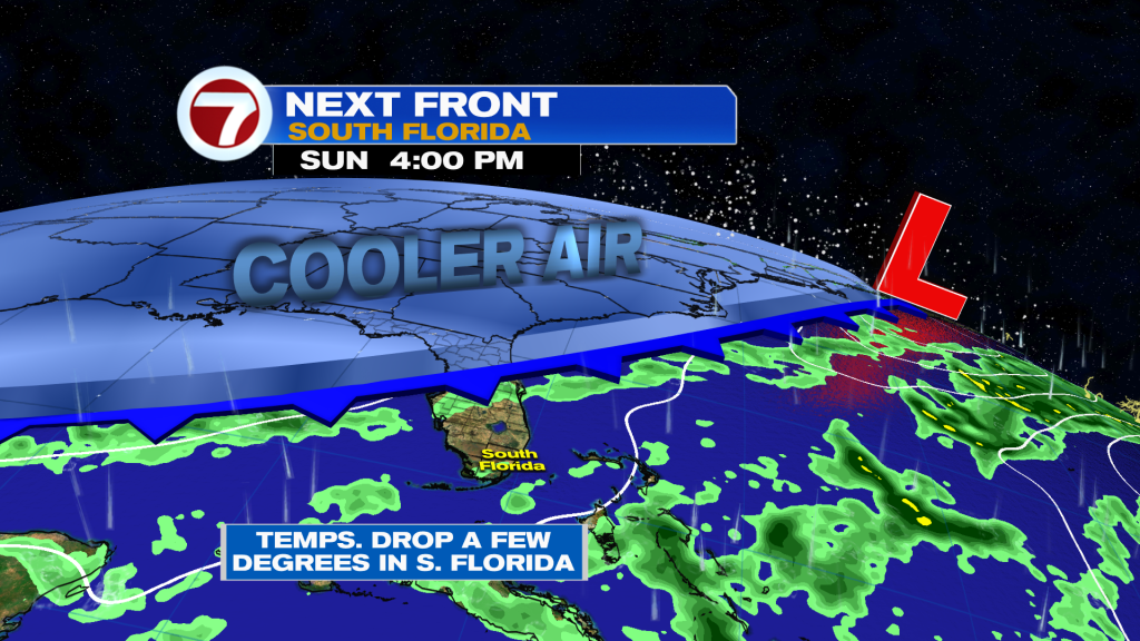
Nicole’s remnants will merge with a cold front in 48 hours and the leading edge of the front should arrive on Sunday. This should help bring temperatures down a few degrees with the humidity early next week.
Thank you for trusting your Storm Station for everything you need to know!
Vivian Gonzalez
Meteorologist, AMS Certified
WSVN Channel 7