The weekend is here and it should be a nice one. Very little in the way of rain is expected for Saturday. If you plan on going to the beaches, there is a risk of Rip Currents. There is also some Red Tide in the water which is an irritant. Check with your local lifeguard before going in the water.
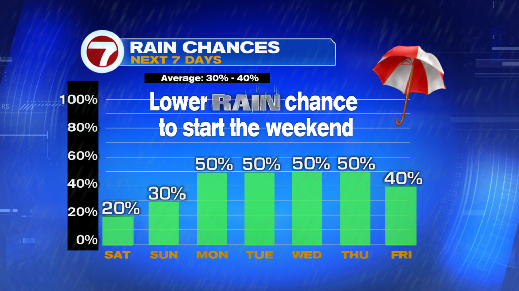
By the second half of the weekend, chances go up as moisture spun out of Tropical Storm Leslie starts to move in. This in combination with a low we are monitoring over the Caribbean, is set to keep us soggy for much of next week.
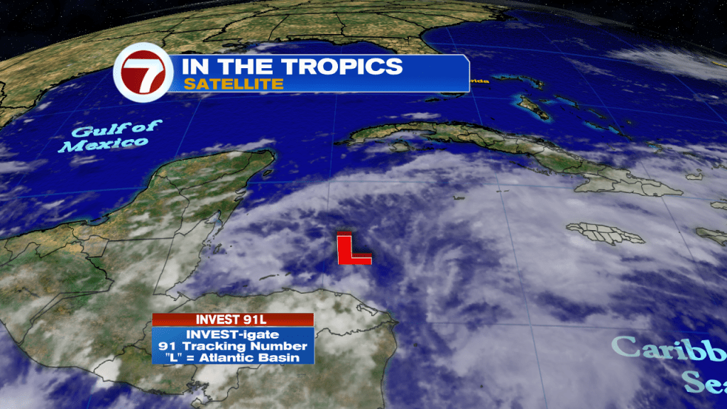
The National Hurricane Center (NHC), is watching the progress of an area of Low Pressure offshore Honduras in Central America. They are calling it Invest 91 L. Invest stands for an area they would like INVEST-igate further,91 is a tracking number, and “L” stands for the Atlantic Basin.

Once the Invest enters the area highlighted in Red, NHC is giving it an 80% chance for development over a period of 5 days. A recon mission is on stand-by for this weekend if needed.

The very early spaghetti model runs, keep the low meandering next to Belize and the Yucatan possibly through Saturday, then most are in agreement that it will aim for the Northeastern Gulf of Mexico. High pressure to the East and an oncoming cold front to the West, will create a path for the invest to take.

Even if it doesn’t develop, this low could dump plenty of rain across the region leading to flash floods, land and mudslides.
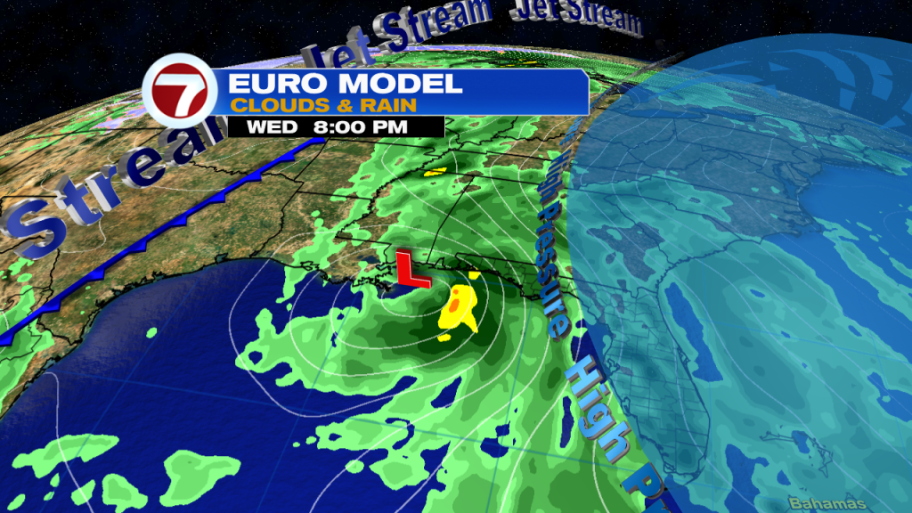
The European model, places a system anywhere between Louisiana and Florida’s Big Bend by next week. We will be watching carefully.