Happy Saturday, South Florida!
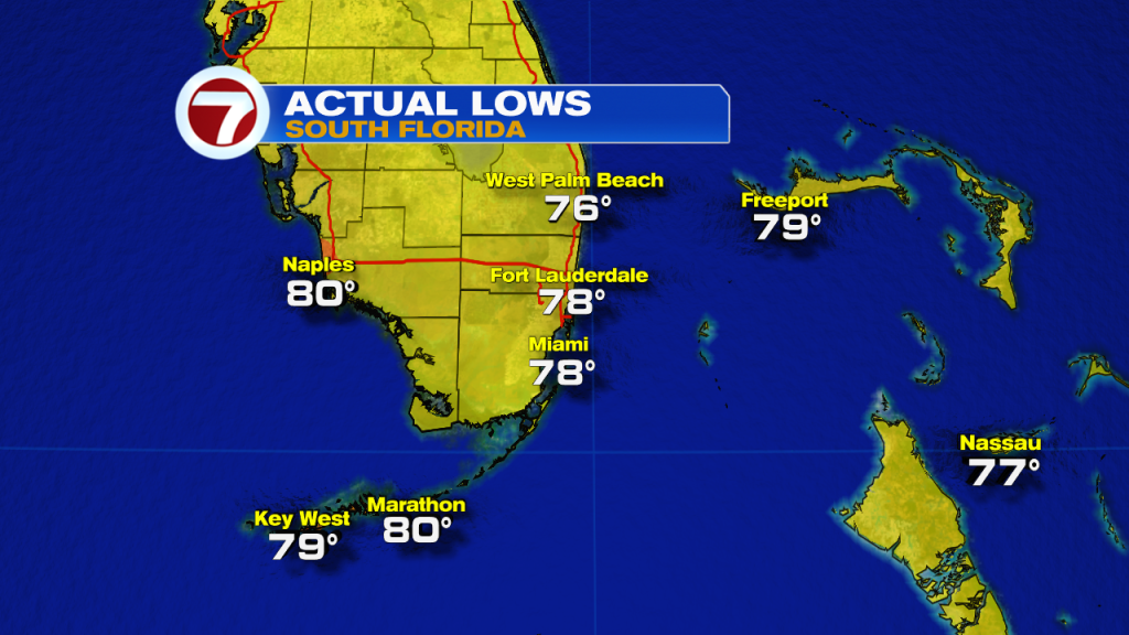
Hopefully everyone had a great week! The weather across South Florida has been quite interesting as we have tied record high temperatures the last couple of days, dealing with brush fires still currently burning and have also seen a good amount of strong thunderstorms throughout the week. And while this may seem quite strange, it is actually quite normal given the transitional period South Florida is currently under. That’s right, a transitional period in the sense that the official start of the wet season is on May 15 and we are slowly transitioning from the dry season over to the wet one. This morning surely felt more like a of wet season kind of start. Our morning temperatures were in the upper 70s to near 80° across many South Florida locations.
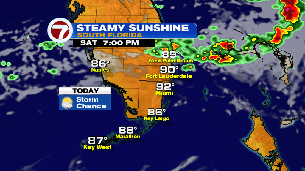
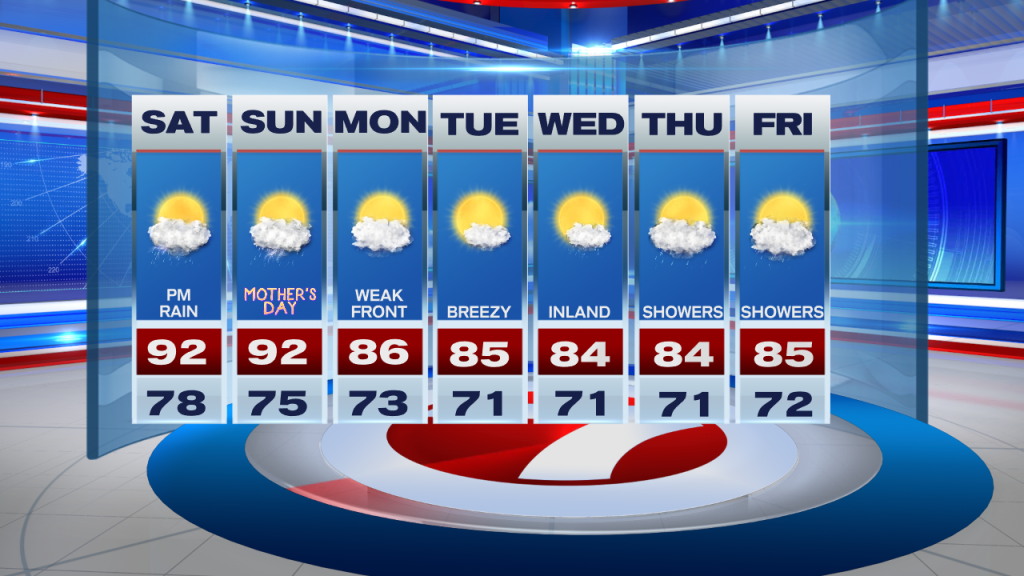
It is a big weekend here in South Florida with lots going on and of course the all important special day on Sunday. First let’s start off with today. We have a high pressure system in the mid and upper levels of the atmosphere but as we have an approaching front, our winds at the surface have already veered out of the Southwest. This means we can once again expect afternoon high temperatures into the 90s. Some areas will once again flirt with records. And while most of the day looks to be on the dry side, due to that Southwest steering flow, showers and thunderstorms will eventually pop and move towards the East Coast metro areas this afternoon. Best chances look to be farther north. So if you have any outdoor plans today (and I’m sure many of us do), be sure to keep the umbrella with you this afternoon.
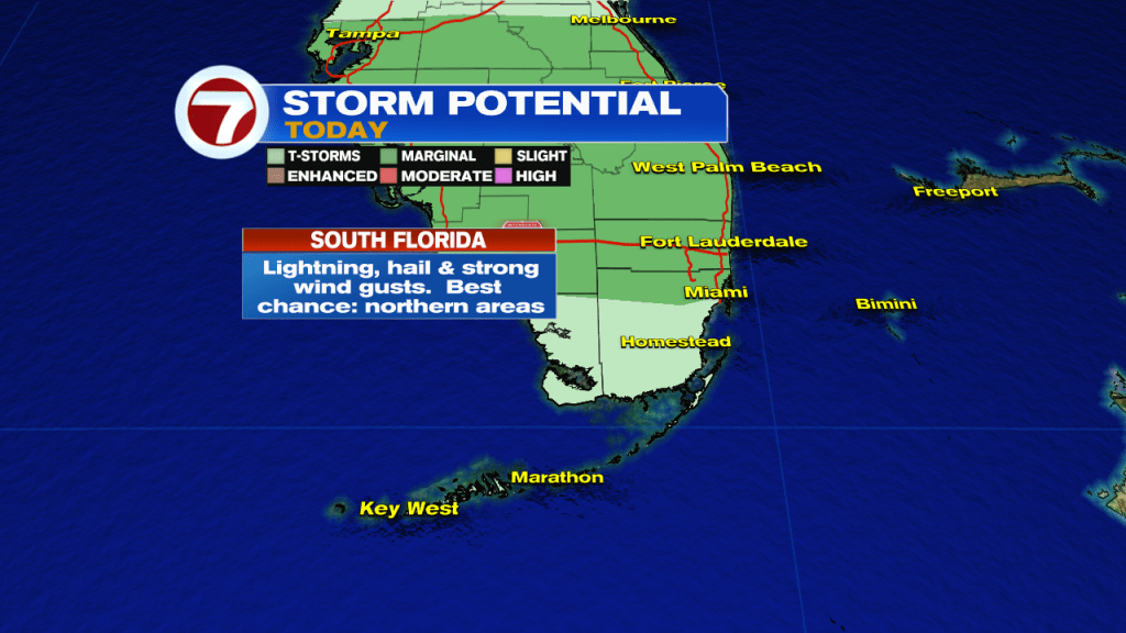
Some of the thunderstorms that do develop today could be on the strong to possibly severe side. And while not ALL of South Florida will see rain and thunderstorms today, those that do can expect the potential for hail, lots of lightning, damaging winds and even a funnel cloud may be possible. So just because most of the day will be a nice one, don’t let your guard down. Let’s keep an eye to the sky and let’s remain informed throughout the day.
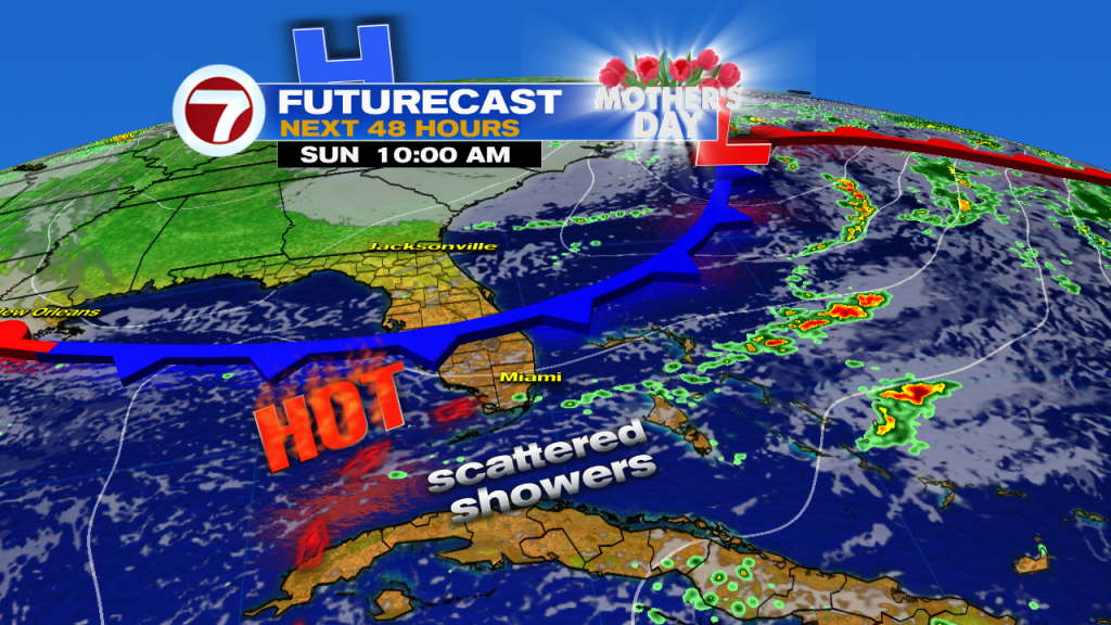
Mom‘s special day (Sunday) will be a bit different. As a front moves closer into our area, we can expect some shower activity on and off. The good news is that the day is not expected to be a washout. So if you have any outdoor plans with mom tomorrow, remember to keep the umbrella with you and be ready to move your plans indoors if rain moves through your area. Worth mentioning is that our temperatures will still reach into the lower 90s on Sunday so regardless of the rain, expect another steamy South Florida spring day. (That might make anyone want to have any meal indoors regardless of the rain!)
Looking ahead, rain chances continue to go down as we head into the start of the work week behind the front. No significant cooling is expected with this Front, however, South Florida will most definitely notice a change. For one, afternoon temperatures will no longer be in the 90s but a bit closer to average nearing the mid 80s. Another noticeable change will be lower humidity, which always seems to help around here!. The breeze may pick up at times during the middle of the work week as an area of low pressure will be parked just off of our coastline. That could also drag in some clouds from time to time. As we work our way into the end of the work week it looks like rain chances once again we get to increase. In the meantime, let’s enjoy a beautiful weekend while we celebrate all the moms out there.
Have a wonderful weekend!
Erika Delgado
Meteorologist
WSVN Channel 7 News
Copyright 2024 Sunbeam Television Corp. All rights reserved. This material may not be published, broadcast, rewritten or redistributed.